
Pretraživanje
Prikaz rezultata 1-10 od 22

Standards in geoinforamation area / Standardi u oblasti geoinformacija
(Republički geodetski zavod Srbije, Beograd, 2010)
The paper gives information about the standards that support current standardization initiatives in geoinformation field. Increasing the reliability of the goods and effectiveness of the services which we use depend on ...
Development of the geodetic services market and the private geodetic practice in the Republic of Serbia / Razvoj tržišta geodetskih poslova i privatne geodetske prakse u Republici Srbiji
(Republički geodetski zavod Srbije, Beograd, 2009)
The paper contains the analysis of the market conditions for the development of the private geodetic practice in the Republic of Serbia following the latest legislative amendments adopted in 2002. The analysis was done ...
The land consolidation in the countries CEE/CIS / Komasacija zemljišta u zemljama centralne i istočne Evrope i zajednice nezavisnih država
(Republički geodetski zavod Srbije, Beograd, 2002)
Each country in transition must find out its own solution for land fragmentation, thus taking already acquired experience and main common principles of the countries in Central and Eastern Europe (CEE) and of the Commonwealth ...
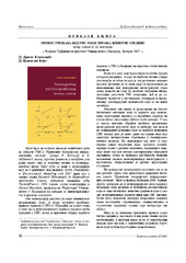
Gerard B. M. Heuvelink, Prenos grešaka kod GIS modeliranja životne sredine, Građevinski fakultet, Beograd, 2007
(Republički geodetski zavod Srbije, Beograd, 2007)
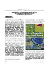
Peter Burrough i Rachael Mcdonnnell: Principi geografskih informacionih sistema - prostorni informacioni sistemi i geostatistika
(Republički geodetski zavod Srbije, Beograd, 2006)
The acquisition of radius of the circle objects inaccessible for the direct measurement / Određivanje prečnika kružnih objekata (cevi) nepristupačnih za direktno merenje
(Republički geodetski zavod Srbije, Beograd, 2003)
This paper deals with the problem of obtaining radius of the circle objects which are heavy to be occupied. It is assumed that we have total station for getting the job.

Activities on improving the process of land consolidation in Serbia / Aktivnosti na unapređenju procesa komasacije u Srbiji
(Republički geodetski zavod Srbije, Beograd, 2006)
Small size of agricultural parcels, great dispersion and uneconomically shaped parcels are some of the main structural problems of Serbian agriculture. Bearing the fact that Serbia is one of the most rural jurisdictions ...

The dividing of a line at a given scale applicated to the digitalization of the points coordinates / Podela duži u datoj srazmeri primenjena na digitalizaciju koordinata tačaka
(Republički geodetski zavod Srbije, Beograd, 2003)
An application of mathematical terms for dividing a given line at a given scale is suggested in the paper. Besides this, it is theoretically shown that a conditional adjustment is present in these simple formulae.

The TEMPUS project implementation on Faculty of civil engineering at the University of Belgrade, Department of geodesy and geoinformatics / Početak implementacije TEMPUS projekta na Građevinskom fakultetu u Beogradu - Odsek za geodeziju i geoinformatiku
(Republički geodetski zavod Srbije, Beograd, 2007)
The paper shows the contents of the TEMPUS project which was established in order to propose new master program in Land administration at the Department of geodesy and geoinformatics on the Faculty of civil engineering.
Business plan of the geodetic enterprise in the foundation / Biznis plan geodetskog preduzeća u osnivanju
(Republički geodetski zavod Srbije, Beograd, 2003)
In this work is described the procedure of the production of the business plan. On the concrete small geodetic enterprise in the foundation has been done the projection of the indispensable financial funds to the beginning ...