
Pretraživanje
Prikaz rezultata 21-30 od 58
Recognition of common areas in a web page using a visualization approach
(Artificial Intelligence: Methodology, Systems and Applications, Proceedings, 2002)
Extracting and processing information from web pages is an important task in many areas like constructing search engines, information retrieval, and data mining from the Web. Common approach in the extraction process is ...
Implementation of the CORINE Land Cover project in Serbia and Montenegro / Implementacija CORINE Land Cover projekta u Srbiji i Crnoj Gori
(Republički geodetski zavod Srbije, Beograd, 2006)
In order to bring Serbia and Montenegro to the same line of activities as the rest of the European countries in relation to assessing the land cover resources, European Commission decided to support implementation of the ...
Historical review of astro-geodetic observations in Serbia
(Proceedings of the Meeting Studying Nature Through Centuries - 120th Anniversary of Belgrade Observa, 2008)
Astro-geodetic determinations of vertical deflections in Serbia began during the first years of 20th century. The first field works were led by S. Boskovic. After the 2nd World War, Military Geographic Institute, Department ...
Procedures and Experiences on Using Desktop Scanner for Orthophoto Production
(International Society for Photogrammetry and Remote SensingCenkler Matbaasi,Istambul, 2004)
Paper presents procedures and experiences on using low cost desktop scanner Epson Expression 1640XL for orthophoto production.Complete process of scanning, scanner calibration and removal of systematic distortions of scanned ...
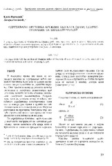
Geological Units Classification of Multispectral Images by Using Support Vector Machines
(2009 International Conference On Intelligent Networking and Collaborative Systems (Incos 2009), 2009)
Quantitative techniques for spatial prediction and classification in geological survey are developing rapidly. The recent applications of machine learning techniques confirm possibilities of their application in this field ...
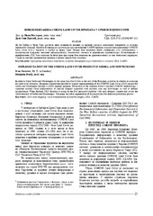
The acquisition of radius of the circle objects inaccessible for the direct measurement / Određivanje prečnika kružnih objekata (cevi) nepristupačnih za direktno merenje
(Republički geodetski zavod Srbije, Beograd, 2003)
This paper deals with the problem of obtaining radius of the circle objects which are heavy to be occupied. It is assumed that we have total station for getting the job.
Testing the stability of gps oscillators within Serbian permanent gps stations network
(19th IMEKO World Congress 2009, 2009)
Periodic tests of quartz oscillators incorporated in GPS receivers in Serbia are performed in accredited metrological laboratories by the procedure adopted in metrological laboratory ML160. However, receivers of Serbian ...
National traceability of GPS measurements in the Republic of Serbia
(20th International Metrology Symposium and 1st Regional Metrology Organisations Symposium 2008, RMO, 2008)
A traceability chain of Global positioning system (GPS) measurements to Serbian national standard UTC(ZMDM) is presented in the paper. An experiment on reproducing the secondary standard ML160 to working standards by ...
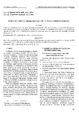
The using GPS cinematic methods in geodetic works / Primena kinematičke metode GPS u geodetskim radovima
(Republički geodetski zavod Srbije, Beograd, 2003)
This article is explaining some standards of using GPS kinematics methods in engineering surveys. Results of GPS measurements were sufficiently accurate compared with data of terrestrial measurement.
Experiences and procedures on making technical documentation for the objects of historical and cultural heritage
(International Society for Photogrammetry and Remote Sensing, 2004)
This paper evaluates advantages of application of digital photogrammetry for the purposes of production of technical documentation for the objects under protection, comparing it with the classical photogrammetric procedures. ...