
Search
Now showing items 31-40 of 120
Sparse regression interaction models for spatial prediction of soil properties in 3D
(Elsevier Ltd, 2018)
An approach for using lasso (Least Absolute Shrinkage and Selection Operator) regression in creating sparse 3D models of soil properties for spatial prediction at multiple depths is presented. Modeling soil properties in ...
Global geographic and feature space coverage of temperature data in the context of spatio-temporal interpolation
(Elsevier, 2015)
This article highlights the results of an assessment of representation and usability of global temperature station data for global spatio-temporal analysis. Datasets from the Global Surface Summary of Day (GSOD) and the ...
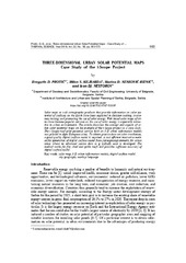
3D urban solar potential maps - case study of the i-SCOPE project
(Belgrade : Vinča Institute of Nuclear Sciences, 2018)
Solar maps as web cartographic products that provide information on solar potential of surfaces on the Earth have been exploited in decision making, awareness raising, and promoting the use of solar energy. Web based solar ...
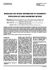
Modelling the spatial distribution of Vojvodina's population by using dasymetric method
(Institut za arhitekturu i urbanizam Srbije, Beograd, 2011)
Cartographic presentation of heterogeneity/homogeneity in the spatial distribution of population is still a major problem in modern geography, and other geo-sciences as well. The traditional method of thematic or choropleth ...
Assessment stability of maize lines yield by gge-biplot analysis
(Društvo genetičara Srbije, Beograd, 2018)
Maize genotypes have varied reactions in different localities, years, treatments or the combination of these factors, due to genotype x year interaction. The objective of this study was to estimate genotype by locality, ...
Analiza postojećeg stanja i potrebe razvoja sistema za procjenu vrijednosti nekretnina u Republici Srbiji / Analysis of actual status and needs for real estate valuation model development in Republic of Serbia
(Union of Associations of Geodetic Professionals in Bosnia and Herzegovina, 2016)
U radu je opisano stanje u oblasti razvoja tzržišta nekretnina u Republici Srbiji, sadašnji nosioci poslova procjene, neki primeri dobre prakse u Evropi i međunarodne organizacije koje tu ...
Value framework for evaluation of land banks/funds
(Zvava Geodetov Slovenije, 2014)
Land banks/funds are one of the most important instruments of rural development. The significance of the land banks/funds in land development was primarily recognized in the Netherlands and Denmark, where land banks had ...
Establishment of the MGI EDM calibration baseline
(Survey Review, 2013)
This paper deals with the estimation of the quality of the baseline for the calibration of distance measurement devices which was established by Serbian Military Geographic Institute for military use. The basic characteristics ...

Recent trends in daily rainfall extremes over Montenegro (1951-2010)
(Copernicus GmbH, 2015)
More intense rainfall may cause a range of negative impacts upon society and the environment. In this study we analysed trends in extreme ETCCDI (Expert Team on Climate Change Detection and Indices) rainfall indices in ...
Variations of total electron content over Serbia during the increased solar activity period in 2013 and 2014
(Zvava Geodetov Slovenije, 2016)
To understand general ionosphere properties over Serbia, an analysis of temporal and spatial ionosphere Total Electron Content (TEC) over the region was performed. The present research focuses on daily, seasonal and spatial ...