Претраживање
Приказ резултата 91-100 од 101
Teaching computing for complex problems in civil engineering and geosciences using big data and machine learning: synergizing four different computing paradigms and four different management domains
(Springer, 2023)
This article describes a teaching strategy that synergizes computing and management, aimed at the running of complex projects in industry and academia, in the areas of civil engineering, physics, geosciences, and a number ...
Long-term rockslope monitoring and rockfall prediction
(International Association for Engineering Geology and the Environment, 2021)
AI in Agriculture
(1st Serbian International Conference on Applied Artificial Intelligence (SICAAI), Kragujevac, Serbia, 2022)
Soil organic carbon represents the main nutrient source for crop yields, which is of great importance to agricultural production. This research investigates the usage of a transfer learning-based neural network model to ...
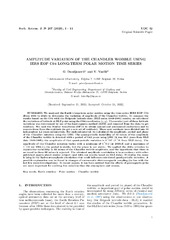
Measuring Chandler Wobble amplitude variations using IERS EOP C04 data
(Astronomska opservatorija i Matematički fakultet - Odeljenje za astronomiju, 2023)
We analyzed the Earth's long-term polar motion using the time series IERS EOP C04 (from 1984 to 2023) to determine the variation of amplitude of the Chandler wobble. To compare the results based on the C04 with the Belgrade ...
One algorithm for testing annulling of mixed trigonometric polynomial functions on boundary points
(TELFOR, ETF, Bulevar kralja Aleksandra 73, 2022)
This paper considers one problem of modern automated
theorem provers. While there are many different numerical
methods for computation of real roots of polynomials, theorem
provers require higher level of assurances of ...
Determinations of the preliminary coordinates for the new GNSS permanent station network in Serbia
(SGEM, 51 Alexander Malinov blvd, Sofia, 1712, Bulgaria, 2022)
The new network of permanent GNSS (Global Navigation Satellite System) stations should be established by the end of this year. At the moment, 18 permanent stations are already established. All stations coordinates must be ...
Коришћење UAV фотограметрије и ласерског скенирања из ваздуха (LiDAR) приликом праћења активности клизишта на Умци
(Универзитет у Београду - Факултет безбедности, 2023)
Клизишта, као природне непогоде, егзистирају годинама, па у неком случајевима и више деценија. Због штетних последица које проузрокују, а како би се потенцијална опасност благовремено уочила и на време спречила, потребно ...
A digital solution for unlocking the urban mining potential of the residential building stock through the integration of BIM and GIS
(Conference on interdisciplinary and transdisciplinary research for sustainable development, 2022)
The construction industry consumes up to half of the excavated primary resources and
generates one-third of total waste annually, impacting the environment and society. To
reduce this impact, maintaining the primary ...
Airborne Laser Scanning to Digital Elevation Model – LAStools approach
(IPSI, Dalmatinska 55, 11000 Belgrade, Serbia, 2023)
Airborne Laser Scanning (ALS) is one of the most popular and cost-effective approaches for collecting Digital Elevation Model (DEM) data. This especially applies to large areas, forested areas, areas with dense vegetation ...