
Претраживање
Приказ резултата 21-30 од 39
Improved Loop-Flow Method for Hydraulic Analysis of Water Distribution Systems
(American Society of Civil Engineers (ASCE), 2018)
Different methods have been developed in the past to formulate and solve steady-state hydraulics of a water distribution system (WDS). The most widely used method nowadays is probably the global gradient algorithm (GGA). ...
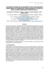
Parametric modeling as geometric tool for designing urban model of biomorphic from inspired by flower of bell flower (Campanula persicifolia L.)
(Serbian Society for Geometry and Graphics (SUGIG) Faculty of Technical Sciences, University of Novi Sad, 2018)
The aim of this research was to apply parametric modeling as appropriate geometric tool in landscape architecture design. Nature model used as inspiration in designing process was flower of the species bell flower (Campanula ...
Chronology of the development of geodetic reference networks in Serbia
(Taylor and Francis Ltd., 2018)
In this paper, the development of geodetic reference networks in Serbia is shown. This historical summary covers the time from the first organised work in 1855 until today. Special attention has been paid to the establishment ...
Modelling extreme values of the total electron content: Case study of Serbia
(Geofizicki Zavod, 2018)
This paper is dedicated to modeling extreme TEC (Total Electron Content) values at the territory of Serbia. For the extreme TEC values, we consider the maximum values from the peak of the 11-year cycle of solar activity ...

The visualization of the medieval site of the Savinac monastery
(Central Institute for Conservation, BelgradeScientific Association for the Development and Promotion of New Technologies, Sopot, 2018)
Contemporary visualization techniques rely on new technological achievements which offer information data collection in the form of a three-dimensional model. Such 3D model is significant in the area of cultural heritage ...
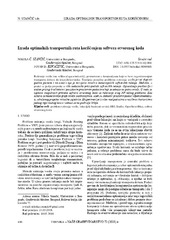
Designing optimal transport routes using open-source software / Izrada optimalnih transportnih ruta korišćenjem softvera otvorenog koda
(Savez inženjera i tehničara Srbije, Beograd, 2018)
Vehicle routing plays a major role in the industry, primarily in companies that organize the transport of goods to end-users. The theoretical background of the vehicle routing problem has been known for many years and it ...

Vehicle swept path analysis based on GPS data
(Canadian Science Publishing, 2018)
Vehicle swept path analysis presents an essential step while working on at-grade intersection and roundabout designs. Following the intensive development of computer-aided design (CAD) software in the past two decades, ...
Automated GNSS monitoring of Umka landslide review of seven years experience and results
(Geological Survey of Slovenia, Ljubljana, 2018)
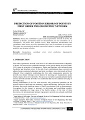
Prediction of position errors of points in first order trigonometric network / Predikcija položajne greške tačaka trigonometrijske mreže prvog reda
(Građevinski fakultet, Subotica, 2018)
During the establishment of first order trigonometric network in Serbia, the influence of Earth’s gravitational field on measurements was not considered. As a consequence, all points have position errors. With additional ...
Three-dimensional urban solar potential maps case study of the i-scope project
(Univerzitet u Beogradu - Institut za nuklearne nauke Vinča, Beograd, 2018)
Solar maps as web cartographic products that provide information on solar potential of surfaces on the Earth have been exploited in decision making, awareness raising, and promoting the use of solar energy. Web based solar ...