
Претраживање
Приказ резултата 91-95 од 95
Коришћење UAV фотограметрије и ласерског скенирања из ваздуха (LiDAR) приликом праћења активности клизишта на Умци
(Универзитет у Београду - Факултет безбедности, 2023)
Клизишта, као природне непогоде, егзистирају годинама, па у неком случајевима и више деценија. Због штетних последица које проузрокују, а како би се потенцијална опасност благовремено уочила и на време спречила, потребно ...
A digital solution for unlocking the urban mining potential of the residential building stock through the integration of BIM and GIS
(Conference on interdisciplinary and transdisciplinary research for sustainable development, 2022)
The construction industry consumes up to half of the excavated primary resources and
generates one-third of total waste annually, impacting the environment and society. To
reduce this impact, maintaining the primary ...
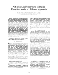
Airborne Laser Scanning to Digital Elevation Model – LAStools approach
(IPSI, Dalmatinska 55, 11000 Belgrade, Serbia, 2023)
Airborne Laser Scanning (ALS) is one of the most popular and cost-effective approaches for collecting Digital Elevation Model (DEM) data. This especially applies to large areas, forested areas, areas with dense vegetation ...
Pre-failure deformation monitoring as rockfall prediction tool
(IOP Publishing, 2021)
In this article, we are elaborating an example of predictive rockfall assessment by
using Terrestrial Laser Scanning (TLS) in monitoring a road cut, hosted in flysch rock formation,
near Ljig in Serbia. A sequence of ...