
Претраживање
Приказ резултата 31-40 од 390
Experience from professional visit to Germany: 'Follow-up' workshop / Iskustva sa stručne posete Nemačkoj - 'follow-up' radionica
(Republički geodetski zavod Srbije, Beograd, 2009)
The paper presents the experience acquired in the study tour, the German education sector, with special attention to the organization of student associations, operating processes cadastral services and private practice students.
Application of digital image correlation in crack width measurement of RC beams
(Društvo građevinskih konstruktera Srbije, Beograd, 2016)
This paper presents the principles of a non-contact, optic metrology method based on digital image correlation (DIC) of a speckle-painted surface. The paper reports a possible application of a 2D DIC method on displacement ...
Sparse regression interaction models for spatial prediction of soil properties in 3D
(Elsevier Ltd, 2018)
An approach for using lasso (Least Absolute Shrinkage and Selection Operator) regression in creating sparse 3D models of soil properties for spatial prediction at multiple depths is presented. Modeling soil properties in ...
Global geographic and feature space coverage of temperature data in the context of spatio-temporal interpolation
(Elsevier, 2015)
This article highlights the results of an assessment of representation and usability of global temperature station data for global spatio-temporal analysis. Datasets from the Global Surface Summary of Day (GSOD) and the ...
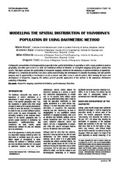
Modelling the spatial distribution of Vojvodina's population by using dasymetric method
(Institut za arhitekturu i urbanizam Srbije, Beograd, 2011)
Cartographic presentation of heterogeneity/homogeneity in the spatial distribution of population is still a major problem in modern geography, and other geo-sciences as well. The traditional method of thematic or choropleth ...
Corrigendum to ‘‘Design and optimization of laser scanning for tunnelsgeometry inspection’’ [Tunnell. Underground Space Technol. 37 (2013)199–206]
(Tunnelling and Underground Space Technology, 2013)
The authors regret that the published version of the abovearticle failed to credit the other authors. The authors regret thatthe printed version of the above article contained this error. The authors would like to apologise ...
Primena 3D terestričkog laserskog skeniranja kosine na putu M-22
(Savez građevinskih inženjera Srbije, Beograd, 2015)
The method of the calculation of the terrain slope in the raster GIS and DTM application / Određivanje nagiba terena u rasterskim GIS i DMT aplikacijama
(Republički geodetski zavod Srbije, Beograd, 2003)
Various methods for the calculation of the terrain slope used in the gridded DTMs are presented in this work. Some of the results obtained from research based on the efficiency of the application of these methods are also ...

Current activities regarding matching the national reference frame to ETRS of Republic of Serbia and the surrounding countries / Dosadašnje aktivnosti uklapanja postojećih državnih koordinatnih sistema u ETRS Republike Srbije i zemalja u okruženju
(Republički geodetski zavod Srbije, Beograd, 2009)
In the world, as well as us, all the greater use of GPS technology, there is a justified need for the determination of transformation models between existing and new reference system. The paper presents a GPS reference ...
Current status and trends of geodetic profession in the Republic of Serbia
(Faculty of Geodesy, Zagreb, 2014)