
Search
Now showing items 61-70 of 405
Expression of the Local GPS Solution in the Regional Reference Frame ETRF2000
(Cham: Springer International Publishing, 2015)
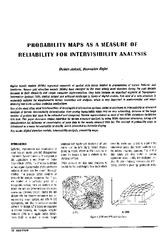
Probability maps as a measure of reliability for indivisibility analysis
(Institut za arhitekturu i urbanizam Srbije, Beograd, 2005)
Digital terrain models (DTMs) represent segments of spatial data bases related to presentation of terrain features and landforms. Square grid elevation models (DEMs) have emerged as the most widely used structure during ...
Metoda laserskog skeniranja u geodetskom inženjerstvu
(Građevinski kalendar, 2017)
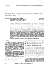
Second order design of geodetic network using different TK structured criterion matrices / Optimizacija drugog reda geodetske mreže korišćenjem različitih kriterijum matrica TK strukture
(Savez inženjera i tehničara Srbije, Beograd, 2012)
Geodetic network design for numerous practical applications (surveying, staking out of characteristic points of an object in construction, control of geometry of a built-up object, monitoring, etc) represents a problem ...
Machine Learning and Landslide Assessment in a GIS Environment
(Cham: Springer International Publishing, 2018)
This chapter introduces theoretical and practical aspects for applying GIS and geocomputation methods in landslide assessment problems. Machine Learning techniques in combination with GIS are proven useful for computation ...
The Role of Cartography in Making a “Smart City”: Case Study of Indjija
(Newcastle upon Tyne: Cambridge Scholars Publishing, 2015)
The goal of “smart city” electronic services is to significantly improve urban life and development with regards to different aspects. The services, built upon various Information and Communication Technologies, are usually ...
Spatial Hedonic Modeling of Housing Prices Using Auxiliary Maps
(Berlin Heidelberg: Springer, 2018)
Crawling the construction web - A machine-learning approach without negative examples
(Applied Artificial Intelligence, 2008)
Professionals and craftsmen in the construction sector make an intensive use of information in their decision-making processes but only make limited use of the abundant information, that is potentially available to them, ...
Maintenance of the state survey in the Republic of Montenegro
(Survey Review, 2018)
The paper provides an overview of the maintenance of the state survey, as the foundation for the development of the geodetic infrastructure, real estate cadastre, mapping and the National Spatial Data Infrastructure (NSDI) ...
Geometric Proportional Schemas of Serbian Medieval Raška Churches Based on Stambuk's Proportional Canon
(Birkhauser Verlag AG, 2019)
In this paper, an analysis of three Serbian medieval Raška churches highlights the significance of the interaction of regular geometric shapes in the composition of their underlying proportional scheme. The complex geometry ...