
Претраживање
Приказ резултата 1-9 од 9
Građevinsko konstrukterstvo
(Savez inženjera i tehničara Srbije, Beograd, 2002)
U ovom radu daje se prikaz razvoja građevinskog konstrukterstva u oblasti betonskih i čeličnih konstrukcija. Pri tome se mostograditeljstvo, kao važan segment konstrukterstva sa specifičnostima projektovanja, građenja i ...
The main project of horizontal deplacement monitoring by geodetic methods at the area of 'Nova Kolubara' / Glavni projekat geodetskog osmatranja horizontalnog pomeranja priobalja reke 'Nova Kolubara'
(Savez inženjera i tehničara Srbije, Beograd, 2010)
The new position of the Kolubara river has been finished since 19.09.2007. Starting from that time, new works are oriented through finishing activities regarding to the new river flow. This article presents the geodetic ...
The education of surveyors in Republic of Serbia / Sistem obrazovanja geodetskog kadra u Republici Srbiji
(Savez inženjera i tehničara Srbije, Beograd, 2009)
In Serbia, like in many other countries, there are three various levels of schools for surveyor's education: secondary, higher and academic (faculty). Except these, we must mention two academic, faculty levels - Master and ...
Adoption of European standards in construction industry as our national standards / Usvajanje evropskih standarda u građevinarstvu kao naših nacionalnih standarda
(Savez inženjera i tehničara Srbije, Beograd, 2006)
The background, aims and content and the actual state of development of Structural Eurocodes are presented in the paper. The review of what have been done in the implementation of European prestandards in our theory and ...
The analysis of horizontal positional accuracy of the Digital topographic map 1:50 000 produced by Military Geographical Institute / Analiza horizontalne položajne tačnosti Digitalne topografske karte 1:50 000 izdanja Vojnogeografskog instituta
(Savez inženjera i tehničara Srbije, Beograd, 2009)
This paper describes methodology used for assessment the horizontal positional accuracy of Digital topographic map in scale 1: 50 000 produced by Military Geographical Institute, and gives review of obtained results. Two ...

The Danube reference geodetic network / Referentna geodetska osnova Dunava
(Savez inženjera i tehničara Srbije, Beograd, 2007)
The Danube is most important river in Europe today. It relates The Western European countries with The Eastern. The safety of the flyway is a primary aim of the Serbian company PLOVPUT which is in charge to make it to be ...
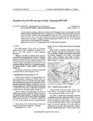
Twenty years from the first GPS measurements in Serbia: Campaign EPVGI90 / 20 godina od prvih GPS merenja u Srbiji - kampanja EPVGI90
(Savez inženjera i tehničara Srbije, Beograd, 2010)
This paper describes measurements and shows the results of the first GPS campaign taken in Serbia, realized by Military Geographical Institute from Belgrade in July 1990, within its Experimental geodetic network. As a ...
The global positioning system in geodetic surveying / Tehnologije globalnog sistema za pozicioniranje u funkciji geodetskog premera
(Savez inženjera i tehničara Srbije, Beograd, 2005)
The main task of the surveying is definition, identification, demarcation, measuring and mapping of the boundaries of the natural and artificial objects on the Earth surface. To define the relationship between points, the ...
Terrestrial laser scanning technology in geodesy / Primena tehnologije terestričkog laserskog skeniranja u geodeziji
(Savez inženjera i tehničara Srbije, Beograd, 2010)
This paper represents a relatively new terrestrial laser scanning technology and discusses its potential in the geodetic applications. In short, this work describes components of stationary laser scanning system, comparison ...