
Претраживање
Приказ резултата 31-40 од 40

Application of a software package Topocad in geodetic works / Primena softverskog paketa Topocad u geodetskim radovima
(Savez inženjera i tehničara Srbije, Beograd, 2011)
Software package Topocad is used for processing and analysis of geodetic measurements. The program is developed by Swedish company Adtollo. It contains all the options that are most frequent in the surveying jobs. This ...
The application of the right rectangular prism in the process determining the value of terrain correction / Primena prave pravougaone prizme u postupku određivanja vrednosti terenske korekcije
(Savez inženjera i tehničara Srbije, Beograd, 2015)
The effects of topographic masses on gravity were determined for the territory of Serbia by using the digital terrain model with resolution of 1 arch second in both directions. For the effect of distant masses, i.e. masses ...

Designing optimal transport routes using open-source software / Izrada optimalnih transportnih ruta korišćenjem softvera otvorenog koda
(Savez inženjera i tehničara Srbije, Beograd, 2018)
Vehicle routing plays a major role in the industry, primarily in companies that organize the transport of goods to end-users. The theoretical background of the vehicle routing problem has been known for many years and it ...

Ocena pomeranja inženjerskih struktura u programskom paketu PANDA
(Savez inzenjera i tehnicara Srbije, 2022)
U radu se opisuje ocena značajnosti pomeranja tačaka deformacione strukture (objekta) geodetskom metodom deformacione analize. Saglasno unapred pretpostavljenom pomeranju strukture, u dva različita plana merenja, simulirani ...
Calibrating and validating a FE model for long-term behavior of RC beams / Kalibracija i verifikacija modela konačnih elemenata za dugotrajno ponašanje AB greda
(Savez inženjera i tehničara Srbije, Beograd, 2014)
This study presents the research carried out in finding an optimal finite element (FE) model for calculating the long-term behavior of reinforced concrete (RC) beams. A multi-purpose finite element software DIANA was used. ...
Uporedna analiza betonskog integralnog nadputnjaka pri različitim karakteristikama tla
(Savez inženjera i tehničara Srbije, Beograd, 2022)
U okviru rada razmatran je betonski integralni nadputnjak raspona 30 metara na magistralnom putu koji je fundiran na šipovima. Analiziran je uticaj krutosti tla na vrednosti statičkih uticaja merodavnih za dimenzionisanje ...

Sustainability of the concrete industry: Current trends and future outlook / Održivost industrije betona - savremeni trendovi i izgledi za budućnost
(Savez inženjera i tehničara Srbije, Beograd, 2017)
Achieving sustainability of all human actions has been recognized as an urgent and top priority since the warnings of anthropogenic climate change are overwhelming. However, the precise goal, aim and method of shifting the ...
Different approach for calculation of inflow on storm water sewer pumping station: Case study KCS Nova 1 on New Belgrade / Mogućnosti za proračun protoka na kišnoj kanalizacionoj crpnoj stanici - primer KCS Nova 1, Novi Beograd
(Savez inženjera i tehničara Srbije, Beograd, 2012)
In the process of making mathematical models, a common problem is lack or missing data that could be used for calibration and verification of the model. In that case, we have to somehow use available data to calculate the ...

Planning for sustainable development of local municipality / Planiranje održivog razvoja jedinice lokalne samouprave u Republici Srbiji
(Savez inženjera i tehničara Srbije, Beograd, 2012)
The problem of Sustainable Municipality development in Republic of Serbia is quite specific. All official agree that the development is quite slow or stopped. Forming the new association of communities and towns the process ...
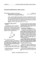
Mathematical models of rhumb line and their application / Matematički modeli loksodrome i njihova primena
(Savez inženjera i tehničara Srbije, Beograd, 2011)
The paper analyses some models of rhumb line on the ellipsoid, sphere and map projection. In geodesy and cartography, rhumb line is a complex curve on the earth's surface that crosses every meridian at the same oblique ...