
Претраживање
Приказ резултата 1-10 од 17
The land consolidation in the countries CEE/CIS / Komasacija zemljišta u zemljama centralne i istočne Evrope i zajednice nezavisnih država
(Republički geodetski zavod Srbije, Beograd, 2002)
Each country in transition must find out its own solution for land fragmentation, thus taking already acquired experience and main common principles of the countries in Central and Eastern Europe (CEE) and of the Commonwealth ...
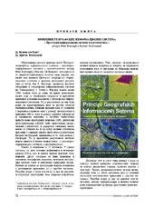
Peter Burrough i Rachael Mcdonnnell: Principi geografskih informacionih sistema - prostorni informacioni sistemi i geostatistika
(Republički geodetski zavod Srbije, Beograd, 2006)
The influence of the density of the mass of the Earth's crust by the computation of the orthometric heights / Uticaj gustine masa zemljine kore pri računanju ortometrijskih visina
(Republički geodetski zavod Srbije, Beograd, 2002)
In the paper is given the analysis of the difference of the power and the geometrical relation leveling superficial and the vertikal. The influence of the force Earth's gravitation was presented on the results of the ...
The Recommendations of the European Union and European Economic Commission about United Nations about of the function land administration / Preporuke Evropske Unije i Evropske Ekonomske Komisije Ujedinjenim Nacijama o funkcionosanju državne uprave
(Republički geodetski zavod Srbije, Beograd, 2002)
In the paper are presented the rules and the recommendations for the successfully function of the state administration in the countries European Union. The paper also presents the recommendations of European Economic ...

The method of the calculation of the terrain slope in the raster GIS and DTM application / Određivanje nagiba terena u rasterskim GIS i DMT aplikacijama
(Republički geodetski zavod Srbije, Beograd, 2003)
Various methods for the calculation of the terrain slope used in the gridded DTMs are presented in this work. Some of the results obtained from research based on the efficiency of the application of these methods are also ...

Current activities regarding matching the national reference frame to ETRS of Republic of Serbia and the surrounding countries / Dosadašnje aktivnosti uklapanja postojećih državnih koordinatnih sistema u ETRS Republike Srbije i zemalja u okruženju
(Republički geodetski zavod Srbije, Beograd, 2009)
In the world, as well as us, all the greater use of GPS technology, there is a justified need for the determination of transformation models between existing and new reference system. The paper presents a GPS reference ...
The application of the coefficients of the spheric harmonious development in the procedure of the determination functionally anomalic potential / Primena koeficijenata sferno-harmonijskog razvoja u postupku određivanja funkcionala anomalijskog potencijala
(Republički geodetski zavod Srbije, Beograd, 2002)
In the procedure of the determining functionally anomalic power, in the frame of the method remove-restore the first step presents the elimination of the long wave characteristics of the functionally with the application ...
Experience from professional visit to Germany: 'Follow-up' workshop / Iskustva sa stručne posete Nemačkoj - 'follow-up' radionica
(Republički geodetski zavod Srbije, Beograd, 2009)
The paper presents the experience acquired in the study tour, the German education sector, with special attention to the organization of student associations, operating processes cadastral services and private practice students.
Implementation of the CORINE Land Cover project in Serbia and Montenegro / Implementacija CORINE Land Cover projekta u Srbiji i Crnoj Gori
(Republički geodetski zavod Srbije, Beograd, 2006)
In order to bring Serbia and Montenegro to the same line of activities as the rest of the European countries in relation to assessing the land cover resources, European Commission decided to support implementation of the ...
The using GPS cinematic methods in geodetic works / Primena kinematičke metode GPS u geodetskim radovima
(Republički geodetski zavod Srbije, Beograd, 2003)
This article is explaining some standards of using GPS kinematics methods in engineering surveys. Results of GPS measurements were sufficiently accurate compared with data of terrestrial measurement.