
Претраживање
Приказ резултата 1-10 од 58
Application of geostatistics in spatial analyses / Primena geostatistike u prostornim analizama
(Srpsko geografsko društvo, Beograd, 2007)
During the last decade, the development of computational technique has influenced wider implementation of numerical methods in different software applications, which are oriented to processing, presentation, and analysis ...
Historical review of astro-geodetic observations in Serbia
(Proceedings of the Meeting Studying Nature Through Centuries - 120th Anniversary of Belgrade Observa, 2008)
Astro-geodetic determinations of vertical deflections in Serbia began during the first years of 20th century. The first field works were led by S. Boskovic. After the 2nd World War, Military Geographic Institute, Department ...
Procedures and Experiences on Using Desktop Scanner for Orthophoto Production
(International Society for Photogrammetry and Remote SensingCenkler Matbaasi,Istambul, 2004)
Paper presents procedures and experiences on using low cost desktop scanner Epson Expression 1640XL for orthophoto production.Complete process of scanning, scanner calibration and removal of systematic distortions of scanned ...
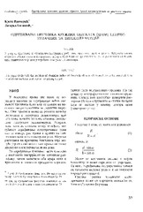
The acquisition of radius of the circle objects inaccessible for the direct measurement / Određivanje prečnika kružnih objekata (cevi) nepristupačnih za direktno merenje
(Republički geodetski zavod Srbije, Beograd, 2003)
This paper deals with the problem of obtaining radius of the circle objects which are heavy to be occupied. It is assumed that we have total station for getting the job.

Implementation of the CORINE Land Cover project in Serbia and Montenegro / Implementacija CORINE Land Cover projekta u Srbiji i Crnoj Gori
(Republički geodetski zavod Srbije, Beograd, 2006)
In order to bring Serbia and Montenegro to the same line of activities as the rest of the European countries in relation to assessing the land cover resources, European Commission decided to support implementation of the ...

Current activities regarding matching the national reference frame to ETRS of Republic of Serbia and the surrounding countries / Dosadašnje aktivnosti uklapanja postojećih državnih koordinatnih sistema u ETRS Republike Srbije i zemalja u okruženju
(Republički geodetski zavod Srbije, Beograd, 2009)
In the world, as well as us, all the greater use of GPS technology, there is a justified need for the determination of transformation models between existing and new reference system. The paper presents a GPS reference ...
The influence of the density of the mass of the Earth's crust by the computation of the orthometric heights / Uticaj gustine masa zemljine kore pri računanju ortometrijskih visina
(Republički geodetski zavod Srbije, Beograd, 2002)
In the paper is given the analysis of the difference of the power and the geometrical relation leveling superficial and the vertikal. The influence of the force Earth's gravitation was presented on the results of the ...

The method of the calculation of the terrain slope in the raster GIS and DTM application / Određivanje nagiba terena u rasterskim GIS i DMT aplikacijama
(Republički geodetski zavod Srbije, Beograd, 2003)
Various methods for the calculation of the terrain slope used in the gridded DTMs are presented in this work. Some of the results obtained from research based on the efficiency of the application of these methods are also ...