
Претраживање
Приказ резултата 1-10 од 148
Terrestrial reference frame of Serbia and its temporal rate
(Državna geodetska uprava, Gruška 20, HR-10000 ZagrebSveučilište u Zagrebu Geodetski fakultet, Kačićeva 26, HR-10000 ZagrebHrvatska komora ovlaštenih inženjera geodezije, Ul. Grada Vukovara 271/II, HR-10000 Zagreb, 2013)
National GPS permanent network of Serbia - Aktivna Geodetska Referentna Osnova Srbije (AGROS) was established in the end of 2005. referring to the ITRF96, where the official geodetic reference system of Serbia was Bessel ...
High resolution daily temperature for Serbia (1960-2015)
(Faculty of Civil Engineering, Belgrade, 2016)
Stormwater Infiltration Modelling / Modeliranje infiltracije kišnog oticaja
(Građevinski fakultet, Subotica, 2014)
An experimental catchment has been established at the Faculty of Civil Engineering in Belgrade to study urban stormwater runoff generation processes as well as measures for water quality improvements and volume decrease. ...
Savremeni aspekti uređenja seoskog prostora - osnovni pristupi
(Univerzitet Crne Gore, Građevinski fakultet, Podgorica, 2014)
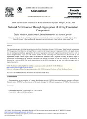
Network Sectorisation Through Aggregation of Strong Connected Components
(Elsevier Ltd, 2017)
This paper presents new algorithm for sectorisation of a Water Distribution Network (WDN) named Water Network Sectorisation (WNS) algorithm. Algorithm relies on Graph Theory to search for the Strong Connected Components ...
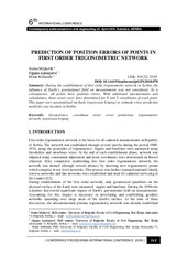
Prediction of position errors of points in first order trigonometric network / Predikcija položajne greške tačaka trigonometrijske mreže prvog reda
(Građevinski fakultet, Subotica, 2018)
During the establishment of first order trigonometric network in Serbia, the influence of Earth’s gravitational field on measurements was not considered. As a consequence, all points have position errors. With additional ...

Automated GNSS monitoring of Umka landslide review of seven years experience and results
(Geological Survey of Slovenia, Ljubljana, 2018)
Accuracy Testing of RTK Service of the Permanent Station Network in the Republic of Serbia
(International Federation of Surveyors, 2009)
Сажетак: Мрежа перманентних станица у Републици Србији је успостављена крајем 2005. године када је и почела да се користи за комерцијалне сврхе. Мрежа је примарно развијена као подршка корисницима у премеру, али такође и ...
National tracebility of GPS measurements in the Republic of Serbia
(International Measurement Confederation, 2008)
Сажетак: У раду је приказана следивост мерења Глобалним GPS позиционим системом до националног стандарда UTC(ZMDM) Србије. Изведен је експеримент репродукције секундарног стандарда ML160 на радне стандарде упоређењем 1PPS ...

Geodetic infrastructure of Serbia
(University of Belgrade - Faculty of Civil Engineering, 2011)
Geodetic reference systems and their realization at the territory of Serbia have been created and maintained since the end of 19th century. Until mid-80s a series of reference geodetic networks were established: ...