Приказ основних података о документу
Geodata management by developing of national data infrastructure in the republic of Serbia
| dc.creator | Aleksić, Ivan R. | |
| dc.creator | Gučević, Jelena | |
| dc.creator | Milićević-Sekulić, Dragana | |
| dc.date.accessioned | 2019-04-19T14:21:36Z | |
| dc.date.available | 2019-04-19T14:21:36Z | |
| dc.date.issued | 2014 | |
| dc.identifier.issn | 0351-0271 | |
| dc.identifier.uri | https://grafar.grf.bg.ac.rs/handle/123456789/590 | |
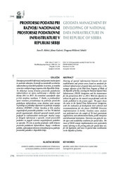
| dc.description.abstract | Sharing of spatial information between the state establishments and private sector, based on standards for technical infrastructure of spatial data and services, is the strategic objective of the Mid-Term Program of Works of the Republic of Serbia, covering the National Spatial Data Infrastructure (NSDI) Instigation and the maintenance for the period from 2011 to 2015. With the objective to achieve the goals set, the research was performed, with the results published in the present paper. The paper shows the status in the Spatial Data Infrastructure instigation; with the evaluation of development level achieved and recommendations for the future INSPIRE Directive implementation in Serbia. Geodata status analysis was performed over the sample of 78 local government organisations, state administration bodies, public enterprises and educational institutions. Overview was given for use, the types and availability conditions for spatial data. The issues of NSDI concept implementation were particularly noted, referring to the pricing policy for spatial data use, for the legislation and issues in spatial data coordination in the Republic of Serbia. | en |
| dc.relation | info:eu-repo/grantAgreement/MESTD/Technological Development (TD or TR)/36020/RS// | |
| dc.relation | info:eu-repo/grantAgreement/MESTD/Integrated and Interdisciplinary Research (IIR or III)/43007/RS// | |
| dc.rights | openAccess | |
| dc.source | Geodetski vestnik | |
| dc.subject | geodata | en |
| dc.subject | spatial data infrastructure | en |
| dc.subject | spatial data management | en |
| dc.subject | geoportal | en |
| dc.title | Geodata management by developing of national data infrastructure in the republic of Serbia | en |
| dc.type | article | |
| dc.rights.license | ARR | |
| dc.citation.epage | 766 | |
| dc.citation.issue | 4 | |
| dc.citation.other | 58(4): 756-766 | |
| dc.citation.rank | M23 | |
| dc.citation.spage | 756 | |
| dc.citation.volume | 58 | |
| dc.identifier.doi | 10.15292/geodetski-vestnik.2014.04.756-766 | |
| dc.identifier.fulltext | https://grafar.grf.bg.ac.rs//bitstream/id/3997/588.pdf | |
| dc.identifier.scopus | 2-s2.0-84924808638 | |
| dc.identifier.wos | 000348314100008 | |
| dc.type.version | publishedVersion |

