
Pretraživanje
Prikaz rezultata 11-20 od 25
Integration of CAD and GIS technology using ArcGIS for development of building information systems / Integracija CAD i GIS tehnologije za potrebe izrade informacionih sistema objekata korišćenjem ARCGIS-a
(Savez inženjera i tehničara Srbije, Beograd, 2014)
Paper will present basic definitions and significance of implementation of information systems for facility maintenance, as well as terms Facility management (FM) and FM lifecycle. The main focus of this paper is on CAD ...
Impact of geo-environmental factors on landslide susceptibility using an AHP method: A case study of Fruška Gora Mt., Serbia
(Univerzitet u Beogradu, Rudarsko-geološki fakultet, 2013)
The paper considers the outcome of multi-criteria analysis of landslide susceptibility on the NW
outskirts of Fruška Gora Mountain, Serbia. The area of the interest is known for landslide occurrences, and to focus on the ...
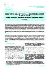
A new methodology for flood damage assessment in urban areas / Nova metodologija za procenu šteta usled plavljenja urbanih površina
(Udruženje za tehnologiju vode i sanitarno inžinjerstvo, Beograd, 2010)
Urban flooding caused by extreme rainfall events is becoming considerably more frequent and more destructive. Thus, enhanced models to predict accurately flood magnitude and location are of paramount importance. These ...
Status of orthophoto production and applications in Serbia
(International Society for Photogrammetry and Remote Sensing, 2004)
Paper reviews achieved level of orthophoto production in Serbia, with estimates on further developments in the next few years. Users, sources of financing, application areas, state and private sector partnership, etc. are ...
Overland flow and pathway analysis for modelling of urban pluvial flooding
(Journal of Hydraulic Research, 2009)
Research on improving an overland flow model is presented for urban pluvial flooding under the dual-drainage concept where sewer flow dynamically interacts with overland flow. This occurs during heavy storms when the sewer ...
Spatial modelling of population concentration using geographically weighted regression method
(Srpska akademija nauka i umetnosti SANU - Geografski institut 'Jovan Cvijić', Beograd, 2011)
This paper presents possibilities of applying the geographically weighted regression method in mapping population change index. During the last decade, this contemporary spatial modeling method has been increasingly used ...
Production of country wide Dtm for serbia and montenegro
(International Society for Photogrammetry and Remote Sensing, 2004)
Project of building country wide DTM for Serbia and Montenegro is coming to its final phase. The project is based on scanning and vectorization of contours from existing 1:25000 topographic maps. Supplementing contour data ...

Laboratory for development of open source geospatial technologies: Role in education and research
(Savez geodeta Srbije, Beograd, 2014)
International Cartographic CBOs (International Cartographic Association-ICA) in partnership with the Open Source Geospatial Foundation-OSGeo has started the initiative ICA-OSGeo Labs to promote and use open source technologies ...
Modelovanje hazarda od klizišta različitim metodama u GIS-u i njihova evaluacija
(Društvo geoloških inženjera i tehničara Srbije - DGEITS, 2012)
Prostorno modelovanje hazarda/potencijala od klizanja može se izvesti najrazličitijim tehnikama u GIS-okruženju ako su prethodno definisani ulazni podaci koji dovolјno korektno diskretizuju model. U ovom radu je izvršena ...
Pregled stanja uvodjenja GIS-a u ViK Srbije
(Udruženje za tehnologiju vode i sanitarno inženjerstvo, 2021)
Geografski informacioni sistemi (GIS) u ViK, sa prikazom softverskih paketa i primerima korišćenja GIS sistema u ViK: JKP Vodovod i kanalizacija, Beograd, JKP Vodovod i kanalizacija, Novi Sad, JKP Vodovod i Kanalizacija, ...