
Претраживање
Приказ резултата 11-20 од 109
Primena DEM-a za morfometrijsku analizu klizišta
(Rudarsko-geološko-građevinski fakultet Univerziteta u Tuzli, 2010)
U ovom radu je prikazana mogućnost kvantitativne i kvalitativne analize morfometrisjkih podataka o klizištu “Umka“ na osnovu digitalnog elevacionog modela (DEM). Kvantitativna analiza je podrazumevala računanje osnovnih ...
3D terrestrial laser scanning and GPS technology for slope stability investigations - case studies
(Macedonian Association for GeotechnicsFaculty of Civil Engineering, Skopje, 2010)
As the rapid adoption of new technologies for landslide and rock slope engineering continues - the natural evolution of equipement for landslide mapping and monitoring has started. The technological evolution of LIDAR ...

Building objects and huseholds inventorying for the purpose of risk estimation on the Umka landslide near Belgrade / Evidentiranje građevinskih objekata i stanovništva za potrebe procene rizika od klizišta Umka kod Beograda
(Srpsko geološko društvo, Beograd, 2018)
The Umka landslide is systematically investigated and one of the biggest inhabited landslides in Serbia. Landslide is active, with known sliding intensity (more or less) for last 50 years, while landslide is old couple of ...
Numerička analiza izgradnje plitkog tunela u beogradskim glinovito-laporovitim sredinama
(Društvo građevinskih konstruktera Srbije, Beograd, 2014)
The rapid urban development, in recent decades, has led to increasing demands for construction and expansion of the underground transport network in large overpopulated cities. An important task in the design of tunnels ...
High cuts on the critical path of the construction of Corridor 10 through Grdelica Gorge: contractual arrangements and site investigations
(Slovensko geotehniško društvo, Ljubljana, 2016)
Modeling of laterally loaded piles using embedded beam elements / Model lateralno opterećenih šipova pomoću „umetnutih“ grednih elemenata
(Građevinski fakultet, Subotica, 2016)
Realistic modeling of pile groups requires the use of complex nonlinear 3D simulations, usually with full discretization of pile continuum. In order to reduce the complexity of these models, as well as the computation time, ...
Kvantifikacija inženjerskogeoloških činilaca za izbor najpovoljnije trase saobraćajnice primenom GIS tehnologije
(Serbian Geological Society, 2010)
U ovom radu inženjersko geološki faktori koji utiču na uslove gradnje puteva, analizirani su korišćenjem GIS tehnologije, zasnovane na metodologiji više-kriterijumske analize koja je razvijena od strane stručnjaka iz ...
Landslide events in Serbia in May 2014: An Overview
(University of Belgrade, Faculty of Mining and Geology, Belgrade, 2015)

Soil-nailing-technique of soil reinforcement / Soil-nailing-tehnika stabilizacije zemljanih masa
(Društvo građevinskih konstruktera Srbije,, 2014)
Soil-nailing tehnika se vec dugi niz godina u svetu uspešno koristi za stabilizaciju i ojacenje zemljanih masa. U nizu geoloških formacija soil-nailing potpornim konstrukcijama se daje prednost u odnosu na tradicionalne ...
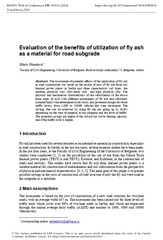
Evaluation of the benefits of utilization of fly ash as a material for road subgrade
(EDP Sciences, 2018)
The assessment of potential effects of the application of fly ash in road construction was based on the results of tests of fly ash from two thermal power plants in Serbia and three characteristic soil types: The medium ...