
Претраживање
Приказ резултата 11-20 од 41

Geodetic control of geometry of engineering facility during construction – case study residential – business facility in Srbac
(Arhitektonsko-gradjevinsko-geodetski fakultet Univerziteta u Banjaluci, 2022)
У раду је приказан поступак геодетске контроле геометрије стамбено-пословног објекта у изградњи, тестирањем сагласности положаја пројектованих и изведених карактеристичних тачака објекта. Описан је и поступак пројектовања ...

Mobile laser scanning for detailed digital topographic mapping / Мобилно ласерско скенирање за детаљно дигитално топографско картирање
(University of Banja Luka Faculty of Architecture, Civil Engineering and Geodesy, 2022)
Mobile Laser Scanning (MLS) is a technique characterized by high data acquisition efficiency and
level of detail. However, a lot of information contained in the LiDAR point cloud is only implicitly
available. Therefore, ...
Kongres metrologa 2022 - Naučni odbor
(Kongres metrologa 2022, 2022)
Društvo metrologa je formirano u cilju objedinjavanja aktivnosti svih metrologa, pružanju pomoći prilikom njihovog rada i međusobne razmene iskustava.
Misija Društva metrologa je da okuplja i podstiče stručnjake koji ...
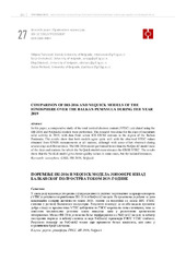
Comparison of IRI-2016 and NEQUICK models of the ionosphere over the Balkan Peninsula during the year 2019 / Поређење IRI-2016 и NEQUICK модела јонофере изнад Балканског полуострва током 2019. године
(University of Banja Luka, Faculty of Architecture, Civil Engineering and Geodesy, 2022)
In this paper, a comparative study of the total vertical electron content (VTEC) calculated using the IRI-2016 and NeQuick2 models were performed. The research was done for the days of maximum solar activity in 2019, with ...
Generalized habitat map of Serbia
(14th Symposium on the Flora of Southeastern Serbia and Neighboring Regions, 2022)
The generalized habitat map of Serbia is one of the products of the project carried out for the needs of the Institute for Nature Protection of Serbia by the Faculty of Biology University of Belgrade in cooperation with ...
The impact of the Atmospheric Parameters at Electrooptical Distance Measurements
(International Federation of Surveyors, FIG, 2022)
The electro-optical distance measurement (EDM) instruments are widely used not only in geodesy but also in almost all engineering disciplines and related projects. High accuracy length measurements are required especially ...
Quantifying tall structure tilting trend through TLS-based 3D parametric modelling
(Elsevier, 2022)
Geodetic monitoring of a tall structure means employing various methods of measurement and data processing for assessing its verticality. Terrestrial laser scanning (TLS) is a method of collecting lots of quality spatial ...
On F-Contractions: A survey
(Universal Wiser Publisher, 2022)
D. Wardowski proved in 2012 a generalization of Banach
Contraction Principle by introducing F-contractions in metric spaces.
In the next ten years, a great number of researchers used Wardowski's
approach, or some of its ...
Validation and comparison of several global geopotential models with an official quasigeoid solution of Serbia
(Association of Surveyors of Slovenia, 2022)
This study aims to analyze the quality of several local reference
quasigeoid surfaces obtained from several Global Geopotential
Models (GGM) relative to the official quasigeoid solution
of Serbia (SQM2011) and GNSS/dh ...
Ocena pomeranja inženjerskih struktura u programskom paketu PANDA
(Savez inzenjera i tehnicara Srbije, 2022)
U radu se opisuje ocena značajnosti pomeranja tačaka deformacione strukture (objekta) geodetskom metodom deformacione analize. Saglasno unapred pretpostavljenom pomeranju strukture, u dva različita plana merenja, simulirani ...