
Search
Now showing items 11-20 of 28
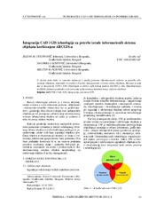
Integration of CAD and GIS technology using ArcGIS for development of building information systems / Integracija CAD i GIS tehnologije za potrebe izrade informacionih sistema objekata korišćenjem ARCGIS-a
(Savez inženjera i tehničara Srbije, Beograd, 2014)
Paper will present basic definitions and significance of implementation of information systems for facility maintenance, as well as terms Facility management (FM) and FM lifecycle. The main focus of this paper is on CAD ...
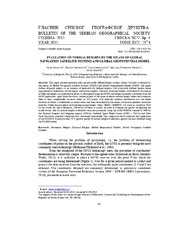
Evaluation of normal heights by the means of global navigation satellite systems and global Geopotential Model / Ocena normalnih visina primenom globalnih navigacionih satelitskih sistema i globalnih geopotencijalnih modela
(Srpsko geografsko društvo, Beograd, 2015)
This paper presents geometrically and physically defined height systems, along with their evaluation by the means of Global Navigation Satellite Systems (GNSS) and Global Geopotential Models (GGM). The paper defines ellipsoid ...
Application of a software package Topocad in geodetic works / Primena softverskog paketa Topocad u geodetskim radovima
(Savez inženjera i tehničara Srbije, Beograd, 2011)
Software package Topocad is used for processing and analysis of geodetic measurements. The program is developed by Swedish company Adtollo. It contains all the options that are most frequent in the surveying jobs. This ...
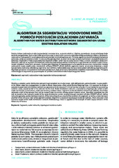
Algorithm for water distribution network segmentation using existing isolation valves / Algoritam za segmentaciju vodovodne mreže pomoću postojećih izolacionih zatvarača
(Udruženje za tehnologiju vode i sanitarno inžinjerstvo, Beograd, 2014)
Dividing a complex water distribution network (segmentation) on smaller zones, with defined entry and exit points, is a precondition for better water loss management. In order to obtain these zones, often called District ...

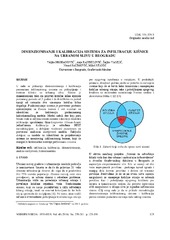
Еталонирање терестричких ласерских скенера у лабораторијским условима
(Техника, 2019)
Терестричко ласерско скенирање (ТЛС) представља методу брзог прикупљања велике количине података у виду „облака тачака“ који нам касније представља основу за приказивање реалног стања „објекта“ у виду тродимензионалног ...
Designing optimal transport routes using open-source software / Izrada optimalnih transportnih ruta korišćenjem softvera otvorenog koda
(Savez inženjera i tehničara Srbije, Beograd, 2018)
Vehicle routing plays a major role in the industry, primarily in companies that organize the transport of goods to end-users. The theoretical background of the vehicle routing problem has been known for many years and it ...
Sizing and calibration of urban stormwater infiltration system in Belgrade / Dimenzionisanje i kalibracija sistema za infiltraciju kišnice na urbanom slivu u Beogradu
(Jugoslovensko društvo za odvodnjavanje i navodnjavanje, Beograd, 2016)
This work shows a way to size and calibrate parameters of urban stormwater collection and treatment infiltration system. Its design allows collection of stormwater runoff events for a 2 year return period and infiltration ...
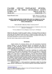
Mapping probabilities of precipitation occurrence on the territory of the Republic of Serbia by the method of indicator kriging / Kartiranje verovatnoća pojave kišnih padavina na teritoriji Republike Srbije metodom indikatorskog kriginga
(Srpsko geografsko društvo, Beograd, 2013)
This paper presents the application of indicator kriging as a geostatistical method for the purpose of creating maps of precipitation occurrence probabilities on the territory of the Republic of Serbia for distinctive ...
Concept of implementation of consolidation in Serbia / Koncept sprovođenja komasacije u Republici Srbiji
(Savez inženjera i tehničara Srbije, Beograd, 2016)
Land consolidation means a system of spatial planning, technical, legal and socio-economic measures takes by the community for a fundamental improvement of natural, economic and environmental conditions of the land territory ...
Spatial modelling of population concentration using geographically weighted regression method
(Srpska akademija nauka i umetnosti SANU - Geografski institut 'Jovan Cvijić', Beograd, 2011)
This paper presents possibilities of applying the geographically weighted regression method in mapping population change index. During the last decade, this contemporary spatial modeling method has been increasingly used ...