Search
Now showing items 31-40 of 405

Data Models for Moving Objects in Road Networks – Implementation and Experiences
(Research Group Cartography, Vienna University of Technology, 2014)
Paper deals with the specific LBS scenario – Fleet management (FM) and more specifically with systems for Automatic vehicle location (AVL). Well designed and implemented spatial data model for moving objects is one of the ...
Status of orthophoto production and applications in Serbia
(International Society for Photogrammetry and Remote Sensing, 2004)
Paper reviews achieved level of orthophoto production in Serbia, with estimates on further developments in the next few years. Users, sources of financing, application areas, state and private sector partnership, etc. are ...
Terrain correction computations using digital density model of topographic masses
(Zvava Geodetov Slovenije, 2018)
This paper presents the determination of terrain correction by the means of the Digital Density Model (DDM) of topographic masses (Earth's crust mass above the geoid) for the territory of Serbia. The DDM is determined using ...
Expression of the Local GPS Solution in the Regional Reference Frame ETRF2000
(Cham: Springer International Publishing, 2015)
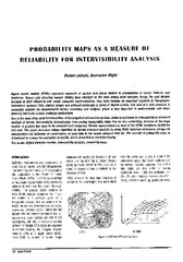
Probability maps as a measure of reliability for indivisibility analysis
(Institut za arhitekturu i urbanizam Srbije, Beograd, 2005)
Digital terrain models (DTMs) represent segments of spatial data bases related to presentation of terrain features and landforms. Square grid elevation models (DEMs) have emerged as the most widely used structure during ...
Metoda laserskog skeniranja u geodetskom inženjerstvu
(Građevinski kalendar, 2017)
Second order design of geodetic network using different TK structured criterion matrices / Optimizacija drugog reda geodetske mreže korišćenjem različitih kriterijum matrica TK strukture
(Savez inženjera i tehničara Srbije, Beograd, 2012)
Geodetic network design for numerous practical applications (surveying, staking out of characteristic points of an object in construction, control of geometry of a built-up object, monitoring, etc) represents a problem ...
Machine Learning and Landslide Assessment in a GIS Environment
(Cham: Springer International Publishing, 2018)
This chapter introduces theoretical and practical aspects for applying GIS and geocomputation methods in landslide assessment problems. Machine Learning techniques in combination with GIS are proven useful for computation ...
Estimation of vertical accuracy of digital terrain model FABDEM on the territory of the republic of Serbia
(SGEM, 51 Alexander Malinov blvd, Sofia, 1712, Bulgaria, 2022)
In 2004, a digital terrain model (DTM) was created in Serbia. It was obtained by vectorizing isohypses on topographic maps with a scale of 1: 25000. The resolution of the digital model of Serbia is 30 m, and the vertical ...