
Претраживање
Приказ резултата 41-50 од 405
The method of the calculation of the terrain slope in the raster GIS and DTM application / Određivanje nagiba terena u rasterskim GIS i DMT aplikacijama
(Republički geodetski zavod Srbije, Beograd, 2003)
Various methods for the calculation of the terrain slope used in the gridded DTMs are presented in this work. Some of the results obtained from research based on the efficiency of the application of these methods are also ...
Prototype of the 3D Cadastral System Based on a NoSQL Database and a JavaScript Visualization Application
(2019)
3D cadastral systems are more complex than traditional cadastral systems and they require more complex technical solutions and innovative use of developing technologies. Regarding data integrity and data consistency, 3D ...
Current activities regarding matching the national reference frame to ETRS of Republic of Serbia and the surrounding countries / Dosadašnje aktivnosti uklapanja postojećih državnih koordinatnih sistema u ETRS Republike Srbije i zemalja u okruženju
(Republički geodetski zavod Srbije, Beograd, 2009)
In the world, as well as us, all the greater use of GPS technology, there is a justified need for the determination of transformation models between existing and new reference system. The paper presents a GPS reference ...
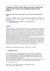
Comparison of ARX-and AR-Models and of the Assumed Form of the Transfer Function when Examining Settlement of the Building
(International Federation of Surveyors, FIG, Prague, 2014)
Current status and trends of geodetic profession in the Republic of Serbia
(Faculty of Geodesy, Zagreb, 2014)
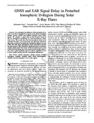
GNSS and SAR Signal Delay in Perturbed Ionospheric D-Region During Solar X-Ray Flares
(IEEE (Institute of Electrical and Electronics Engineers), 2019)
We investigate the influence of the perturbed (by a solar X-ray flare) ionospheric D-region on the GNSS and SAR signals. We calculate a signal delay in the D-region based on the low ionospheric monitoring by very low ...
Application of Google Maps API service for creating web map of information retrieved from CORINE land cover databases / Primena Google Maps API servisa za izradu web karte informacija izvedenih iz CORINE baza podataka o zemljišnom pokrivaču
(Srpsko geografsko društvo, Beograd, 2010)
Today, Google Maps API application based on Ajax technology as standard web service; facilitate users with publication interactive web maps, thus opening new possibilities in relation to the classical analogue maps. CORINE ...
Dasymetric modelling of population dynamics in urban areas
(Geodetski vestnik, 2013)
Solving the problem of publicly available census data disaggregation has preoccupied numerous researchers intensively A noteworthy advance in the methodology was made thanks to the contemporary storage and presentation of ...
Geological, morphologic and pedologic components of the teroir of Smederevka / Geološki, morfološki i pedološki činioci teorara Smederevke
(Srpsko geološko društvo, Beograd, 2018)
Terroir depicts a set of pedologic, micro‐climatic and historical factors that have a say in deciding whether and where to practice viticulture and determines its qualitative and quantitative exploitation potential. For ...
Multihazard Exposure Assessment on the Valjevo City Road Network
(Elsevier, 2019)