
Pretraživanje
Prikaz rezultata 211-214 od 214

Kriterijumi za primenu hibridnog modela 3D katastra u Srbiji
(Savez inženjera i tehničara Srbije, 2024)
3D katastar kao savremeni pristup razvoju katastarskog informacionog sistema donosi mnoge prednosti i rešava poteškoće koje ima sadašnji katastarski sistem kada je reč o upisu i vizualizaciji 3D kompleksnih situacija. ...
The Development of Land Readjustment Models in Serbia and South-East Europe
(MDPI, 2022)
Land readjustment (LR) is increasingly applied as a tool of urban policy implementation in many countries of the world. In Serbia, LR is a new tool that is being introduced into the legal system and into planning practice, ...
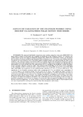
Measuring Chandler Wobble amplitude variations using IERS EOP C04 data
(Astronomska opservatorija i Matematički fakultet - Odeljenje za astronomiju, 2023)
We analyzed the Earth's long-term polar motion using the time series IERS EOP C04 (from 1984 to 2023) to determine the variation of amplitude of the Chandler wobble. To compare the results based on the C04 with the Belgrade ...
Airborne Laser Scanning to Digital Elevation Model – LAStools approach
(IPSI, Dalmatinska 55, 11000 Belgrade, Serbia, 2023)
Airborne Laser Scanning (ALS) is one of the most popular and cost-effective approaches for collecting Digital Elevation Model (DEM) data. This especially applies to large areas, forested areas, areas with dense vegetation ...