
Search
Now showing items 41-50 of 405
Primena 3D terestričkog laserskog skeniranja kosine na putu M-22
(Savez građevinskih inženjera Srbije, Beograd, 2015)
The method of the calculation of the terrain slope in the raster GIS and DTM application / Određivanje nagiba terena u rasterskim GIS i DMT aplikacijama
(Republički geodetski zavod Srbije, Beograd, 2003)
Various methods for the calculation of the terrain slope used in the gridded DTMs are presented in this work. Some of the results obtained from research based on the efficiency of the application of these methods are also ...
Current activities regarding matching the national reference frame to ETRS of Republic of Serbia and the surrounding countries / Dosadašnje aktivnosti uklapanja postojećih državnih koordinatnih sistema u ETRS Republike Srbije i zemalja u okruženju
(Republički geodetski zavod Srbije, Beograd, 2009)
In the world, as well as us, all the greater use of GPS technology, there is a justified need for the determination of transformation models between existing and new reference system. The paper presents a GPS reference ...
Current status and trends of geodetic profession in the Republic of Serbia
(Faculty of Geodesy, Zagreb, 2014)
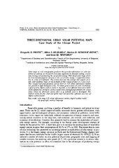
Three-dimensional urban solar potential maps case study of the i-scope project
(Univerzitet u Beogradu - Institut za nuklearne nauke Vinča, Beograd, 2018)
Solar maps as web cartographic products that provide information on solar potential of surfaces on the Earth have been exploited in decision making, awareness raising, and promoting the use of solar energy. Web based solar ...
Air Temperature Prediction / Предикција температуре ваздуха
(ГИС Центар, Београд, Србија, 2018)
Air temperature is one of the most often measured meteorological parameters. Precise air temperature measurements are done in meteorological stations, whose spatial distribution may be uneven and for some applications ...
Crawling the construction web - A machine-learning approach without negative examples
(Applied Artificial Intelligence, 2008)
Professionals and craftsmen in the construction sector make an intensive use of information in their decision-making processes but only make limited use of the abundant information, that is potentially available to them, ...
Identification of movements using different geodetic methods of deformation analysis
(Geodetski vestnik, 2015)
This paper is based on comparative analysis of applied analysis methods on geodetic networks deformation, based on two-dimensional components of GNSS baseline vectors simulated by two epochs, for the purpose of identifying ...
Моделирање регионалних деформација земљине коре и стабилности референтног система
(Универзитет у Београду, Грађевински факултет, 2016)
Ова дисертација је урађена у контексту наставка геодетских истраживања реализације и стабилности односно временске еволуције Tерестричког Референтног Система и савремених померања Земљине коре регионалног карактера која ...