
Search
Now showing items 31-40 of 268
Advanced Loop-flow Method for Fast Hydraulic Simulations
(EasyChair,, 2018)
Solution of the nonlinear system of equations describing the network hydraulics problem can be formulated in several different manners, yielding various methods of solution. The most popular formulation is probably the ...
Application of geostatistics in spatial analyses / Primena geostatistike u prostornim analizama
(Srpsko geografsko društvo, Beograd, 2007)
During the last decade, the development of computational technique has influenced wider implementation of numerical methods in different software applications, which are oriented to processing, presentation, and analysis ...
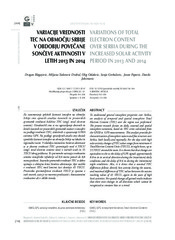
Variations of total electron content over Serbia during the increased solar activity period in 2013 and 2014
(Zvava Geodetov Slovenije, 2016)
To understand general ionosphere properties over Serbia, an analysis of temporal and spatial ionosphere Total Electron Content (TEC) over the region was performed. The present research focuses on daily, seasonal and spatial ...
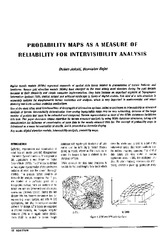
Probability maps as a measure of reliability for indivisibility analysis
(Institut za arhitekturu i urbanizam Srbije, Beograd, 2005)
Digital terrain models (DTMs) represent segments of spatial data bases related to presentation of terrain features and landforms. Square grid elevation models (DEMs) have emerged as the most widely used structure during ...
Metoda laserskog skeniranja u geodetskom inženjerstvu
(Građevinski kalendar, 2017)

Second order design of geodetic network using different TK structured criterion matrices / Optimizacija drugog reda geodetske mreže korišćenjem različitih kriterijum matrica TK strukture
(Savez inženjera i tehničara Srbije, Beograd, 2012)
Geodetic network design for numerous practical applications (surveying, staking out of characteristic points of an object in construction, control of geometry of a built-up object, monitoring, etc) represents a problem ...
Control of geometry of engineering facilities by geodetic methods / Kontrola geometrije inženjerskih objekata geodetskim metodama
(Savez građevinskih inženjera Srbije, Beograd, 2013)
In this paper we present a method for control of geometry of engineering facility by geodetic methods. Control of geometry can be performed by location, shape and size and shape only. Paper also presents all necessary ...
Comparison of expert, deterministic and Machine Learning approach for landslide susceptibility assessment in Ljubovija Municipality, Serbia
(Geofizika, 2017)
Landslide Susceptibility Assessment is becoming a very productive re-search area, wherein different modeling approaches are practiced to delineate zones of the high-low likelihood of landslide occurrence. However, ...
Sensitivity of vegetation indices derived from Sentinel-2 data to change in biophysical characteristics
(Faculty of Civil Engineering, Belgrade, 2016)
Моделирање регионалних деформација земљине коре и стабилности референтног система
(Универзитет у Београду, Грађевински факултет, 2016)
Ова дисертација је урађена у контексту наставка геодетских истраживања реализације и стабилности односно временске еволуције Tерестричког Референтног Система и савремених померања Земљине коре регионалног карактера која ...