
Претраживање
Приказ резултата 1431-1440 од 1482
Service life design of concrete structures, Part 2: Verifications for different deterioration mechanisms / Projektovanje betonskih konstrukcija prema upotrebnom veku, deo 2 - proračunski dokazi za različite deteriorizacione mehanizme
(Društvo za ispitivanje i istraživanje materijala i konstrukcija Srbije, Beograd, 2008)
Service life design is based on quantifying of the deterioration mechanisms of concrete structures. This paper presents the physical or chemical models for two most important deterioration mechanisms: carbonation induced ...

Structural concrete with partial or total cement replacemnet with fly ash / Konstrukcijski betoni sa delimičnom ili potpunom zamenom cementa elektrofilterskim pepelom
(Savez građevinskih inženjera Srbije, Beograd, 2015)
Building industry is facing with great challenges in directing its activities towards sustainable development. Environmental protection, the use of waste and recycled materials and reduction of the use of non-renewable ...
Numerical analysis of glulam beams reinforced with cfrp plates
(Taylor and Francis Ltd., 2017)
This paper presents an analysis of bending behaviour of glued laminated timber (glulam) beams reinforced with carbon fibre reinforced polymer (CFRP) plates, based on finite element numerical modelling. Nonlinear 3-dimensional ...
Flexural reinforcement of glulam beams with CFRP plates
(Kluwer Academic Publishers, 2016)
In recent years the use of fiber reinforced polymer composites for strengthening and repairing structural elements has significantly increased. This paper shows an experimental study carried out in order to demonstrate the ...
Glulam beams externally reinforced with cfrp plates
(Statny Drevarsky Vyskumny Ustav, 2016)
An experimental program was undertaken to investigate the effectiveness of carbon fiber reinforced polymer (CFRP) plates as flexural reinforcement of glued laminated timber (glulam) beams. Beams with and without reinforcement ...
Snow Cover Estimation Using Sentinel-2 High Spatial Resolution Data. A Case Study: National Park Šar Planina (Serbia)
(Springer, Cham, 2022)
Remote sensing, presented in the form of high-resolution satellite images, is essential in monitoring snow cover and the state of the environment. Due to the increase in the spatial resolution of the images, the Sentinel-2 ...
Positional accuracy of geographical information and recent standards for its evaluation / Položajna tačnost geografskih informacija i savremeni standardi za njeno ocenjivanje
(Srpsko geografsko društvo, Beograd, 2011)
Positional accuracy is important quantity element of quality of geographical information in digital as well as in analoguos form. This paper points to importance and necessity of evaluation of positional accuracy in recent ...
Evaluation of positional accuracy of digital topographic maps at scale 1:25 000 (DTM25) on the basis of STANAG 2215 standard / Ocenka pozicionnoj točnosti na cifrovoj topografičeskoj karte masštaba 1:25 000 (TK25), razrabotannoj v sootvetstvii so standartom «STANAG 2215»
(Univerzitet odbrane u Beogradu - Institut za naučne informacije, Beograd, 2018)
The paper describes the results of the positional accuracy assessment of digital topographic maps at scale 1: 25 000 produced by the Serbian Military Geographic Institute (MGI). The test for the horizontal and vertical ...
The survey with the application of the modern measure instruments / Snimanje tačaka detalja primenom savremenih mernih uređaja - prednosti i nedostatci
(Republički geodetski zavod Srbije, Beograd, 2003)
The paper deals with implementation of modern technologies in cadastral surveying. Advantages and disadvantages of modern technologies are analyzed referred to classical equipment used so far. It is known that GPS can ...
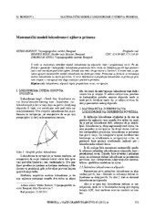
Mathematical models of rhumb line and their application / Matematički modeli loksodrome i njihova primena
(Savez inženjera i tehničara Srbije, Beograd, 2011)
The paper analyses some models of rhumb line on the ellipsoid, sphere and map projection. In geodesy and cartography, rhumb line is a complex curve on the earth's surface that crosses every meridian at the same oblique ...