
Pretraživanje
Prikaz rezultata 3031-3040 od 3463
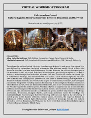
Modeling the interior sunlight effects of Studenica Monastery
(Virtual Workshop: Natural Light in Medieval Churches Between Bizantium and West, 2020)
The local path of the Sun influences the architecture of our buildings. We have developed a model to measure the amount of sunlight that will pass through the windows of the Studenica Monastery Church. This model is general ...
Game and creation - spatial ability test aided by 3D models and AR cell phone application
(Central Institute for Conservation ; Scientific Association for the Development and Promotion of New Technologies, Belgrade ; Sopot, 2017)
Contemporary computer software tools for 3D modeling opened new possibilities in the design process of spatial ability tests, which contain geometric solids and their orthographic projections. 3D computer environment, which ...
Floods in the Sava River Basin in May 2014
(Proceedings of the Mediterranean Meeting on Monitoring, modelling and early warning of extreme events triggered by heavy rainfalls . PON 01_01503 - MED-FRIEND project University of Calabria, Cosenza (Italy), June 26th-28th, 2014, 2014)
Positional accuracy of geographical information and recent standards for its evaluation / Položajna tačnost geografskih informacija i savremeni standardi za njeno ocenjivanje
(Srpsko geografsko društvo, Beograd, 2011)
Positional accuracy is important quantity element of quality of geographical information in digital as well as in analoguos form. This paper points to importance and necessity of evaluation of positional accuracy in recent ...
Evaluation of positional accuracy of digital topographic maps at scale 1:25 000 (DTM25) on the basis of STANAG 2215 standard / Ocenka pozicionnoj točnosti na cifrovoj topografičeskoj karte masštaba 1:25 000 (TK25), razrabotannoj v sootvetstvii so standartom «STANAG 2215»
(Univerzitet odbrane u Beogradu - Institut za naučne informacije, Beograd, 2018)
The paper describes the results of the positional accuracy assessment of digital topographic maps at scale 1: 25 000 produced by the Serbian Military Geographic Institute (MGI). The test for the horizontal and vertical ...
The survey with the application of the modern measure instruments / Snimanje tačaka detalja primenom savremenih mernih uređaja - prednosti i nedostatci
(Republički geodetski zavod Srbije, Beograd, 2003)
The paper deals with implementation of modern technologies in cadastral surveying. Advantages and disadvantages of modern technologies are analyzed referred to classical equipment used so far. It is known that GPS can ...
Uspostava geodetske mreže primjenom globalnih navigacionih satelitskih sistema
(Univerzitet u Banjaluci, Arhitektonsko-građevinsko-geodetski fakultet, Banja Luka, 2016)
Mathematical models of rhumb line and their application / Matematički modeli loksodrome i njihova primena
(Savez inženjera i tehničara Srbije, Beograd, 2011)
The paper analyses some models of rhumb line on the ellipsoid, sphere and map projection. In geodesy and cartography, rhumb line is a complex curve on the earth's surface that crosses every meridian at the same oblique ...