
Претраживање
Приказ резултата 1-10 од 163

SoilGrids250m: Global gridded soil information based on machine learning
(Public Library of Science, 2017)
This paper describes the technical development and accuracy assessment of the most recent and improved version of the SoilGrids system at 250m resolution (June 2016 update). SoilGrids provides global predictions for standard ...

Concept of spatial coordinate systems, their defining and implementation as a precondition in geospatial applications / Koncept prostornih koordinatnih sistema, njihovo definisanje i realizacija kao preduslov u geoprostornim primenama
(Srpsko geografsko društvo, Beograd, 2015)
There are many users of spatial information, and quite large interest about the nature and genesis of such information. Different users found spatial information in the form of maps, plans or alphanumerical tables. Recently, ...
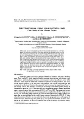
Three-dimensional urban solar potential maps case study of the i-scope project
(Univerzitet u Beogradu - Institut za nuklearne nauke Vinča, Beograd, 2018)
Solar maps as web cartographic products that provide information on solar potential of surfaces on the Earth have been exploited in decision making, awareness raising, and promoting the use of solar energy. Web based solar ...
Air Temperature Prediction / Предикција температуре ваздуха
(ГИС Центар, Београд, Србија, 2018)
Air temperature is one of the most often measured meteorological parameters. Precise air temperature measurements are done in meteorological stations, whose spatial distribution may be uneven and for some applications ...

The possibilities of application of 3D digital models in cultural heritage objects' protection and revitalisation
(Serbian Society for Geometry and Graphics (SUGIG) ; Faculty of Civil Engineering, University ; Akademska misao, Belgrade, 2016)
Contemporary cultural heritage protection relies on precise technical documentation obtained by new technology accomplishments in the domain of 3D digital models. Both 3D models of the existing state of object and virtual ...
Analiza postojećeg stanja i potrebe razvoja sistema za procjenu vrijednosti nekretnina u Republici Srbiji / Analysis of actual status and needs for real estate valuation model development in Republic of Serbia
(Union of Associations of Geodetic Professionals in Bosnia and Herzegovina, 2016)
U radu je opisano stanje u oblasti razvoja tzržišta nekretnina u Republici Srbiji, sadašnji nosioci poslova procjene, neki primeri dobre prakse u Evropi i međunarodne organizacije koje tu ...
Modeliranje urbanih slivova na osnovu javno dostupnih podataka
(Univerzitet u Beogradu, Građevinski fakultet, Beograd, 2016)
Comparison of ARX-and AR-Models and of the Assumed Form of the Transfer Function when Examining Settlement of the Building
(International Federation of Surveyors, FIG, Prague, 2014)
Permanent geodetic monitoring of the Umka Landslide using GNSS technology and GeoMoss system
(University of Belgrade, Faculty of Mining and Geology, Belgrade, 2015)