
Претраживање
Приказ резултата 11-15 од 15
Using nosql databases in the 3d cadastre domain
(Zvava Geodetov Slovenije, 2017)
The 3D cadastre concept brings data models, which are more complex than traditional 2D cadastral data models and could be followed by a large amount of data. The 3D cadastral data should be stored in database management ...
TLS data georeferencing - error sources and effects
(Laboratório nacional de engenharia civil, Lisboa, 2017)
Depending on the requirements of a certain engineering task, point coordinates obtained through terrestrial laser scanning (TLS) can be either in a scanner coordinate system (CS) or in the coordinate system ...
Technical implementation of the national spatial data infrastructure in Serbia
(Strojarski Facultet, 2017)
The paper provides overview of research and studies covering implementation and development of the National Spatial Data Infrastructure (NSDI) concept in Serbia. Research had been done in 2011 divided by 2013, with the ...
Permanent geodetic monitoring of the Umka Landslide using GNSS techonology and GeoMoss system
(University of Belgrade, Faculty of Mining and Geology, Belgrade, 2017)
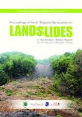
Study of Slow Moving Landslide Umka Near Belgrade, Serbia (IPL-181)
(Advancing Culture of Living With Landslides, Vol 1: Isdr-Icl Sendai Partnerships 2015-2025, 2017)
The IPL project No 181 titled "Study of slow moving landslide Umka near Belgrade" started in November 2012. The study area is located on the right bank of Sava River, 25 km south west of Belgrade, Serbia. The basic objective ...