
Претраживање
Приказ резултата 1-10 од 41
Challenges in P2P Data Management: Clustering
(7th International Conference on Software Engineering Advances, ICSEA 2022, Lisbon, Portugal, 16 - 20. October, 2022)
Intelligent Information Retrieval in Distributed Systems
(4th International Symposium on Smart and Healthy Cities, Shanghai, China, December 16-17, 2022, 2022)
Estimation of vertical accuracy of digital terrain model FABDEM on the territory of the republic of Serbia
(SGEM, 51 Alexander Malinov blvd, Sofia, 1712, Bulgaria, 2022)
In 2004, a digital terrain model (DTM) was created in Serbia. It was obtained by vectorizing isohypses on topographic maps with a scale of 1: 25000. The resolution of the digital model of Serbia is 30 m, and the vertical ...
Практикум - Геодетски премер 2
(Грађевински факултет, Универзитет у Београду, 2022)
Performance of reinforced concrete buildings during the November 26, 2019 Albania earthquake (Mw 6.4) and December 29, 2020 Petrinja earthquake (Mw 6.4)
(3rd European Conference on Earthquake Engineering & Seismology, 2022)
Past earthquakes have affected millions of people whose lives changed within a minute, and caused damage or collapse of thousands of buildings and infrastructure systems. In many cases, earthquakes have long-term consequences. ...

How to implement PBL into a learning process
(Erazmus GEOBIZ project, 2022)
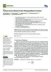
Various Series Related to the Polylogarithmic Function
(MDPI, 2022)
We derive some series related to the polylogarithmic function, and we also give a new proof
to the existing series. Our approach is based on using the summation and integral representation
methods. We obtain various ...
Quantifying tall structure tilting trend through TLS-based 3D parametric modelling
(Elsevier, 2022)
Geodetic monitoring of a tall structure means employing various methods of measurement and data processing for assessing its verticality. Terrestrial laser scanning (TLS) is a method of collecting lots of quality spatial ...

Comparison of IRI-2016 and NEQUICK models of the ionosphere over the Balkan Peninsula during the year 2019 / Поређење IRI-2016 и NEQUICK модела јонофере изнад Балканског полуострва током 2019. године
(University of Banja Luka, Faculty of Architecture, Civil Engineering and Geodesy, 2022)
In this paper, a comparative study of the total vertical electron content (VTEC) calculated using the IRI-2016 and NeQuick2 models were performed. The research was done for the days of maximum solar activity in 2019, with ...
The impact of the Atmospheric Parameters at Electrooptical Distance Measurements
(International Federation of Surveyors, FIG, 2022)
The electro-optical distance measurement (EDM) instruments are widely used not only in geodesy but also in almost all engineering disciplines and related projects. High accuracy length measurements are required especially ...