
Претраживање
Приказ резултата 41-50 од 105
Gravitacioni gradiometri koji se koriste u satelitskim misijama - princip rada i merne karakteristike
(Građevinski fakultet, Univerzitet u Beogradu, Beograd, 2015)
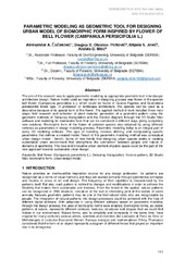
Parametric modeling as geometric tool for designing urban model of biomorphic from inspired by flower of bell flower (Campanula persicifolia L.)
(Serbian Society for Geometry and Graphics (SUGIG) Faculty of Technical Sciences, University of Novi Sad, 2018)
The aim of this research was to apply parametric modeling as appropriate geometric tool in landscape architecture design. Nature model used as inspiration in designing process was flower of the species bell flower (Campanula ...
APPLICATION OF PBL MODEL ON STUDY PROGRAM OF GEODESY AT THE FACULTY OF ARCHITECTURE, CIVIL ENGINEERING AND GEODESY AT THE UNIVERSITY OF BANJALUKA
(Arhitektonsko-Gradjevinsko-Geodetski fakultet Unverziteta u Banjojluci, 2020)
The subject of this paper is the application of the PBL model in the teaching process of the first cycle of studies at the Faculty of Architecture, Civil Engineering and Geodesy. The meaning of the term PBL model and its ...
Automated GNSS monitoring of Umka landslide review of seven years experience and results
(Geological Survey of Slovenia, Ljubljana, 2018)

Network Sectorisation Through Aggregation of Strong Connected Components
(Elsevier Ltd, 2017)
This paper presents new algorithm for sectorisation of a Water Distribution Network (WDN) named Water Network Sectorisation (WNS) algorithm. Algorithm relies on Graph Theory to search for the Strong Connected Components ...
Prediction of position errors of points in first order trigonometric network / Predikcija položajne greške tačaka trigonometrijske mreže prvog reda
(Građevinski fakultet, Subotica, 2018)
During the establishment of first order trigonometric network in Serbia, the influence of Earth’s gravitational field on measurements was not considered. As a consequence, all points have position errors. With additional ...
Assessment of settlement analysis methods based on the monitoring of building located in New Belgrade / Ocena metoda za proračun sleganja na osnovu geodetskog monitoringa na izvedenom objektu na Novom Beogradu
(Društvo građevinskih konstruktera, Beograd, 2014)
This paper provides an assessment of empirical correlations between soil deformation parameters and tip resistance of cone penetrometer test (CPT), by comparing calculated settlements of an object on the rigid foundation ...
Calibration of the levelling rods using laser interferometer
(International Multidisciplinary Scientific Geoconference, 2017)
In this paper, a method of calibration of the levelling rod Carl Zeiss Jena No. 55822 was proposed. Within a method procedures we follow the requirement of the International Standard ISO/IEC 17025: 2005 and all necessary ...

The Preliminary Damage Assessment of Properties Based on Massive Appraisal Maps
(Faculty of Mining, Geology and Petroleum Engineering, University of Zagreb ; Faculty of Civil Engineering, University of Rijeka, Zagreb ; Rijeka, 2014)
High resolution daily temperature for Serbia (1960-2015)
(Faculty of Civil Engineering, Belgrade, 2016)