
Претраживање
Приказ резултата 1-10 од 10
Menadžment u geodeziji
(2010)

Standards in geoinforamation area / Standardi u oblasti geoinformacija
(Republički geodetski zavod Srbije, Beograd, 2010)
The paper gives information about the standards that support current standardization initiatives in geoinformation field. Increasing the reliability of the goods and effectiveness of the services which we use depend on ...
Shuttle radar topography mission: Availability of data and the accuracy achieved / Shuttle radar topography mission - dostupnost podataka i ostvarena tačnost
(Srpsko geografsko društvo, Beograd, 2010)
This paper aim is to determine accuracy of digital terrain model (DTM) formed upon Shuttle Radar Topography Mission (SRTM) data, for the region of the Republic of Serbia. Main characteristics of SRTM will be introduced, ...
The main project of horizontal deplacement monitoring by geodetic methods at the area of 'Nova Kolubara' / Glavni projekat geodetskog osmatranja horizontalnog pomeranja priobalja reke 'Nova Kolubara'
(Savez inženjera i tehničara Srbije, Beograd, 2010)
The new position of the Kolubara river has been finished since 19.09.2007. Starting from that time, new works are oriented through finishing activities regarding to the new river flow. This article presents the geodetic ...
European vertical and gravimetric reference systems / Vertikalni i gravimetrijski referentni sistemi Evrope
(Republički geodetski zavod Srbije, Beograd, 2010)
The paper provides an overview of height and gravity reference systems of Europe and a brief description of their implementation. For each system we have given definitions of the system, as well as changes in definitions ...
Application of Google Maps API service for creating web map of information retrieved from CORINE land cover databases / Primena Google Maps API servisa za izradu web karte informacija izvedenih iz CORINE baza podataka o zemljišnom pokrivaču
(Srpsko geografsko društvo, Beograd, 2010)
Today, Google Maps API application based on Ajax technology as standard web service; facilitate users with publication interactive web maps, thus opening new possibilities in relation to the classical analogue maps. CORINE ...
Digital terrain models as topographic layouts for civil engineering design / Digitalni modeli terena kao podloge za projektovanje u građevinarstvu
(Savez građevinskih inženjera Srbije, Beograd, 2010)
The concept and the production of Digital Terrain Models (DTM) has drawn a lot of attention of spatial data users. In addition to numerous improvements that were made in data collection technologies, big market with wide ...
Terrestrial laser scanning technology in geodesy / Primena tehnologije terestričkog laserskog skeniranja u geodeziji
(Savez inženjera i tehničara Srbije, Beograd, 2010)
This paper represents a relatively new terrestrial laser scanning technology and discusses its potential in the geodetic applications. In short, this work describes components of stationary laser scanning system, comparison ...
Примена активне геодетске референтне основе Србије у премеру непокретности
(Универзитет у Београду, Грађевински факултет, 2010)
Предмет овог рада представљају могућности и проблеми примене Активне
геодетске референтне основе Србије (АГРОС) при позиционирању тачака пасивне
геодетске основе и тачака детаља премера непокретности. АГРОС омогућује
рутинско ...
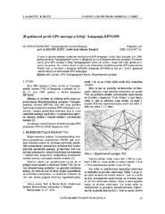
Twenty years from the first GPS measurements in Serbia: Campaign EPVGI90 / 20 godina od prvih GPS merenja u Srbiji - kampanja EPVGI90
(Savez inženjera i tehničara Srbije, Beograd, 2010)
This paper describes measurements and shows the results of the first GPS campaign taken in Serbia, realized by Military Geographical Institute from Belgrade in July 1990, within its Experimental geodetic network. As a ...