
Search
Now showing items 1-10 of 25

Integration of CAD and GIS technology using ArcGIS for development of building information systems / Integracija CAD i GIS tehnologije za potrebe izrade informacionih sistema objekata korišćenjem ARCGIS-a
(Savez inženjera i tehničara Srbije, Beograd, 2014)
Paper will present basic definitions and significance of implementation of information systems for facility maintenance, as well as terms Facility management (FM) and FM lifecycle. The main focus of this paper is on CAD ...

GIS in development of urban plan: Example of Vrnjačka Banja / GIS u izradi urbanističkog plana - primer Vrnjačke Banje
(Institut za arhitekturu i urbanizam Srbije, Beograd, 2009)
This paper illustrate experiences of GIS based spatial geodatabase design realization and development for implementation and monitoring of urban plans. As key study authors used Urban Plan of Vrnjačka Banja created in year ...
Modelovanje hazarda od klizišta različitim metodama u GIS-u i njihova evaluacija
(Društvo geoloških inženjera i tehničara Srbije - DGEITS, 2012)
Prostorno modelovanje hazarda/potencijala od klizanja može se izvesti najrazličitijim tehnikama u GIS-okruženju ako su prethodno definisani ulazni podaci koji dovolјno korektno diskretizuju model. U ovom radu je izvršena ...

Evolving GIS technologies in nature conservation and the spatial planning strategy of Tara NP (Serbia) as a potential UNECSO MAB reserve / Primena GIS tehnologija u zaštiti prirodnih potencijala i strategiji prostornog planiranja NP Tara (Srbija) kao potencijalnog UNESCO MAB rezervata
(Srpsko geografsko društvo, Beograd, 2008)
Mt. Tara NP was nominated in 2004 within the UNESCO - ROSTE programme, for Man and the Biosphere (MAB) Reserve status in Serbia as transboundary 'Peace Park' status between Serbia and Bosnia & Herzegovina. Mt. Tara is one ...

Fuzzy view of environment / Fuzzy pogled na životno okruženje
(Srpska akademija nauka i umetnosti SANU - Geografski institut 'Jovan Cvijić', Beograd, 2007)
A period of fifty years has been reached since the introduction of the first applications based upon geographical information systems (GIS). GIS has not only influenced the development of methods, collection techniques, ...

Kvantifikacija inženjerskogeoloških činilaca za izbor najpovoljnije trase saobraćajnice primenom GIS tehnologije
(Serbian Geological Society, 2010)
U ovom radu inženjersko geološki faktori koji utiču na uslove gradnje puteva, analizirani su korišćenjem GIS tehnologije, zasnovane na metodologiji više-kriterijumske analize koja je razvijena od strane stručnjaka iz ...
Monitoring Air Pollution Using GIS: Case Study for the City of Belgrade
(University of Belgrade - Faculty of Civil Engineering, 2019)
The methodology for modeling the distribution of certain air pollutant for the city of Belgrade in winter 2015 is presented in the paper. Land Use Regression (LUR) was used for modeling and visualization of spatial ...
Impact of geo-environmental factors on landslide susceptibility using an AHP method: A case study of Fruška Gora Mt., Serbia
(Univerzitet u Beogradu, Rudarsko-geološki fakultet, 2013)
The paper considers the outcome of multi-criteria analysis of landslide susceptibility on the NW
outskirts of Fruška Gora Mountain, Serbia. The area of the interest is known for landslide occurrences, and to focus on the ...
Land-use suitability analysis of Belgrade city suburbs using machine learning algorithm
(Institute of geoinformatics VŠB - Technical University of Ostrava, 2013)
This paper treats development issues of the suburban areas of Belgrade city. A considerable growth that the city had experienced has led to excessive consumption of land and also to degradation of the landscape and loss ...
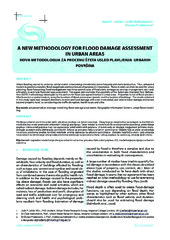
A new methodology for flood damage assessment in urban areas / Nova metodologija za procenu šteta usled plavljenja urbanih površina
(Udruženje za tehnologiju vode i sanitarno inžinjerstvo, Beograd, 2010)
Urban flooding caused by extreme rainfall events is becoming considerably more frequent and more destructive. Thus, enhanced models to predict accurately flood magnitude and location are of paramount importance. These ...