
Претраживање
Приказ резултата 21-30 од 255
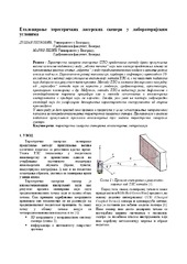
Еталонирање терестричких ласерских скенера у лабораторијским условима
(Техника, 2019)
Терестричко ласерско скенирање (ТЛС) представља методу брзог прикупљања велике количине података у виду „облака тачака“ који нам касније представља основу за приказивање реалног стања „објекта“ у виду тродимензионалног ...

Designing optimal transport routes using open-source software / Izrada optimalnih transportnih ruta korišćenjem softvera otvorenog koda
(Savez inženjera i tehničara Srbije, Beograd, 2018)
Vehicle routing plays a major role in the industry, primarily in companies that organize the transport of goods to end-users. The theoretical background of the vehicle routing problem has been known for many years and it ...
Robust estimation of the normal-distribution parameters by use of structural partitioning-Perobls D method
(American journal of computational mathematics, 2019)
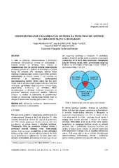
Sizing and calibration of urban stormwater infiltration system in Belgrade / Dimenzionisanje i kalibracija sistema za infiltraciju kišnice na urbanom slivu u Beogradu
(Jugoslovensko društvo za odvodnjavanje i navodnjavanje, Beograd, 2016)
This work shows a way to size and calibrate parameters of urban stormwater collection and treatment infiltration system. Its design allows collection of stormwater runoff events for a 2 year return period and infiltration ...
Automatsko kartriranje klimatskih varijabli primenom prostorno-vremenskih geostatičkih metoda / Automated mapping of climatic variables using spatio-temporal geostatistical methods
(Универзитет у Београду, Грађевински факултет, 2013)
Javno dostupni meteorološki podaci, kako sa stanica tako i iz daljinske detekcije, korišćeni su za prostorno vremensku interpolaciju temperature vazduha iznad površine Zemlje. Zastupljenost i pogodnost javno dostupnih ...
A simplified procedure of metrological testing of the terrestrial laser scanners
(Elsevier B.V., 2014)
This paper presents a simplified test procedure of the terrestrial laser scanners (TLS) accuracy investigation by the general criteria of the ISO17123 standard. The proposed procedure covers investigation, analysis and ...

Terrain Surface Modeling Using Triangular Spline Patches
(University of Belgrade - Faculty of Civil Engineering, 2011)
Algorithms and software for digital terrain modeling using TIN based surface model are presented in the paper. Processing of all types of terrain surface data are supported: mass points, local extrema, contours, breaklines, ...
Transformation of classical geodetic control networks 7to international terestrical reference frame by transformation grids
(Geoconference On Informatics, Geoinformatics and Remote Sensing - Conference Proceedings, Vol II, 2013)
In December 2005 a permanent stations network, as an augmentation system of Global Navigation Satellite System (GNSS), was established in Serbia and it has been in use since then and represents an official active geodetic ...
Monitoring active landslide at Umka settlement using UAV photogrammetry
(UNIVERSITY OF MONTENEGRO, FACULTY OF CIVIL ENGINEERING -THE 7th INTERNATIONAL CONFERENCE "CIVIL ENGINEERING - SCIENCE AND PRACTICE", 2020)
The basic idea of the paper is to use UAV photogrammetry for monitoring landslide activities at Umka. The paper describes the monitoring of changes during one year. Two landslide epochs were studied at Umka in the spring, ...
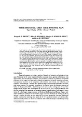
Three-dimensional urban solar potential maps case study of the i-scope project
(Univerzitet u Beogradu - Institut za nuklearne nauke Vinča, Beograd, 2018)
Solar maps as web cartographic products that provide information on solar potential of surfaces on the Earth have been exploited in decision making, awareness raising, and promoting the use of solar energy. Web based solar ...