
Претраживање
Приказ резултата 251-260 од 262
GNSS signals as a tool for detection of the influence of solar radiation of terrestrial ionosphere
(IV Meeting on Astrophysical Spectroscopy - A&M DATA - Atmosphere, BOOK OF ABSTRACTS AND CONTRIBUTED PAPERS, 2022)
Solar radiation has the most significant influence on photo-ionization in the
Earth's ionosphere, and different parts of its spectrum in the UV and X domains
have a dominant role in producing free electrons at different ...
Field procedure for estimation of antenna phase center variation with expanded measurement uncertainty calculation
(University of Montenegro, Faculty of Civil Engineering, 2022)
Antenna phase center of GNSS receiver is the point where the signals transmitted from satellites are collected. However, this point is not necessarily the physical center of antenna (geometric center of antenna). In general, ...
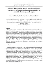
Influence of the periodic changes in the incoming solar hydrogen Ly-α radiation intensity on the total electron content in the ionospheric D-region
(2022)
This paper analyzes variations in the total electron content in the D-region induced by periodical changes in the solar hydrogen Lyα radiation. The considered changes are a consequence of variations in the solar radiation ...

Comparison of IRI-2016 and NEQUICK models of the ionosphere over the Balkan Peninsula during the year 2019 / Поређење IRI-2016 и NEQUICK модела јонофере изнад Балканског полуострва током 2019. године
(University of Banja Luka, Faculty of Architecture, Civil Engineering and Geodesy, 2022)
In this paper, a comparative study of the total vertical electron content (VTEC) calculated using the IRI-2016 and NeQuick2 models were performed. The research was done for the days of maximum solar activity in 2019, with ...

Generalized habitat map of Serbia
(14th Symposium on the Flora of Southeastern Serbia and Neighboring Regions, 2022)
The generalized habitat map of Serbia is one of the products of the project carried out for the needs of the Institute for Nature Protection of Serbia by the Faculty of Biology University of Belgrade in cooperation with ...

Одређивање мерне несигурности резултата мерења просторног растојања применом глобалних навигационих сателитских система / Determination of spatial distance measurement uncertainty using global navigation satellite systems
(Друштво метролога, 2022)
Постоје четири у потпуности успостављена Глобална навигациона сателитска система (ГНСС): амерички GPS NAVSTAR, руски GLONASS, кинески BEIDOU (COMPASS) и европски GALILEO. Њиховом применом успешно се успостављају терестрички ...
Geodetic control of geometry of engineering facility during construction – case study residential – business facility in Srbac
(Arhitektonsko-gradjevinsko-geodetski fakultet Univerziteta u Banjaluci, 2022)
У раду је приказан поступак геодетске контроле геометрије стамбено-пословног објекта у изградњи, тестирањем сагласности положаја пројектованих и изведених карактеристичних тачака објекта. Описан је и поступак пројектовања ...
Sharp Bounds for Trigonometric and Hyperbolic Functions with Application to Fractional Calculus
(MDPI, 2022)
A new situation to note about the obtained boundaries is the symmetry in the upper and lower boundary, where the upper boundary differs by a constant from the lower boundary. New consequences of the inequalities were ...
Методологија контроле геометрије кранских шина геодетским мерењима
(Техника, 2023)
У лабораторији Института за материјале и конструкције Грађевинског факултета у Београду постоји обавезујућа потреба за контролом геометрије постојећих кранских шина. У овом раду приказана је методологија одређивања геометрије ...
Metodologija procene vrednosti zemljišta u procesu urbane komasacije
(Građevinsko-arhitektonski fakultet Univerziteta u Nišu, 2021)
Predmet proučavanje u ovom radu je prikaz metodologije procene vrednosti zemljišta u postupku urbane komasacije. Urbana komasacija je instrument koji se već duže vreme koristi u mnogim zemljama Evrope i sveta u cilju ...