
Претраживање
Приказ резултата 1-7 од 7
Variations of total electron content over Serbia during the increased solar activity period in 2013 and 2014
(Zvava Geodetov Slovenije, 2016)
To understand general ionosphere properties over Serbia, an analysis of temporal and spatial ionosphere Total Electron Content (TEC) over the region was performed. The present research focuses on daily, seasonal and spatial ...
The using GPS cinematic methods in geodetic works / Primena kinematičke metode GPS u geodetskim radovima
(Republički geodetski zavod Srbije, Beograd, 2003)
This article is explaining some standards of using GPS kinematics methods in engineering surveys. Results of GPS measurements were sufficiently accurate compared with data of terrestrial measurement.
Dynamical monitoring of deformation structures in real time / Dinamičko praćenje deformacionih struktura u realnom vremenu
(Jugoslovensko društvo za odvodnjavanje i navodnjavanje, Beograd, 2004)
Deformation of structures are results of the various processes. Measurements techniques which used today give more opportunities for good processes analyses. The importance of getting advanced techniques is in accordance ...

Laser altimetry surveying / Lasersko altimetrijsko snimanje
(Republički geodetski zavod Srbije, Beograd, 2006)
The airborne laser mapping, called LIDAR (LIght Detection And Ranging), provides fast acquisition of a great volume of information on the variation of the surface region through a high density of three-dimensional points, ...

The Danube reference geodetic network / Referentna geodetska osnova Dunava
(Savez inženjera i tehničara Srbije, Beograd, 2007)
The Danube is most important river in Europe today. It relates The Western European countries with The Eastern. The safety of the flyway is a primary aim of the Serbian company PLOVPUT which is in charge to make it to be ...
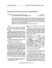
Twenty years from the first GPS measurements in Serbia: Campaign EPVGI90 / 20 godina od prvih GPS merenja u Srbiji - kampanja EPVGI90
(Savez inženjera i tehničara Srbije, Beograd, 2010)
This paper describes measurements and shows the results of the first GPS campaign taken in Serbia, realized by Military Geographical Institute from Belgrade in July 1990, within its Experimental geodetic network. As a ...
The global positioning system in geodetic surveying / Tehnologije globalnog sistema za pozicioniranje u funkciji geodetskog premera
(Savez inženjera i tehničara Srbije, Beograd, 2005)
The main task of the surveying is definition, identification, demarcation, measuring and mapping of the boundaries of the natural and artificial objects on the Earth surface. To define the relationship between points, the ...