
Search
Now showing items 1-10 of 35
Application of geostatistics in spatial analyses / Primena geostatistike u prostornim analizama
(Srpsko geografsko društvo, Beograd, 2007)
During the last decade, the development of computational technique has influenced wider implementation of numerical methods in different software applications, which are oriented to processing, presentation, and analysis ...
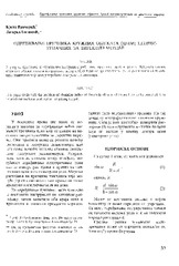
The acquisition of radius of the circle objects inaccessible for the direct measurement / Određivanje prečnika kružnih objekata (cevi) nepristupačnih za direktno merenje
(Republički geodetski zavod Srbije, Beograd, 2003)
This paper deals with the problem of obtaining radius of the circle objects which are heavy to be occupied. It is assumed that we have total station for getting the job.
Experience from professional visit to Germany: 'Follow-up' workshop / Iskustva sa stručne posete Nemačkoj - 'follow-up' radionica
(Republički geodetski zavod Srbije, Beograd, 2009)
The paper presents the experience acquired in the study tour, the German education sector, with special attention to the organization of student associations, operating processes cadastral services and private practice students.

The method of the calculation of the terrain slope in the raster GIS and DTM application / Određivanje nagiba terena u rasterskim GIS i DMT aplikacijama
(Republički geodetski zavod Srbije, Beograd, 2003)
Various methods for the calculation of the terrain slope used in the gridded DTMs are presented in this work. Some of the results obtained from research based on the efficiency of the application of these methods are also ...

Current activities regarding matching the national reference frame to ETRS of Republic of Serbia and the surrounding countries / Dosadašnje aktivnosti uklapanja postojećih državnih koordinatnih sistema u ETRS Republike Srbije i zemalja u okruženju
(Republički geodetski zavod Srbije, Beograd, 2009)
In the world, as well as us, all the greater use of GPS technology, there is a justified need for the determination of transformation models between existing and new reference system. The paper presents a GPS reference ...
Implementation of the CORINE Land Cover project in Serbia and Montenegro / Implementacija CORINE Land Cover projekta u Srbiji i Crnoj Gori
(Republički geodetski zavod Srbije, Beograd, 2006)
In order to bring Serbia and Montenegro to the same line of activities as the rest of the European countries in relation to assessing the land cover resources, European Commission decided to support implementation of the ...
The influence of the density of the mass of the Earth's crust by the computation of the orthometric heights / Uticaj gustine masa zemljine kore pri računanju ortometrijskih visina
(Republički geodetski zavod Srbije, Beograd, 2002)
In the paper is given the analysis of the difference of the power and the geometrical relation leveling superficial and the vertikal. The influence of the force Earth's gravitation was presented on the results of the ...
Quality analysis of digital terrain models for the test area Zlatibor / Analiza kvaliteta digitalnog modela terena na lokaciji 'Zlatibor”
(Srpsko geografsko društvo, Beograd, 2003)
Digital terrain models (DTM) have recently become products which substitute standard methods for the terrain relief presentation. As a part of a Geographic Information Systems (GIS) they represent not only a data base ...
The using GPS cinematic methods in geodetic works / Primena kinematičke metode GPS u geodetskim radovima
(Republički geodetski zavod Srbije, Beograd, 2003)
This article is explaining some standards of using GPS kinematics methods in engineering surveys. Results of GPS measurements were sufficiently accurate compared with data of terrestrial measurement.
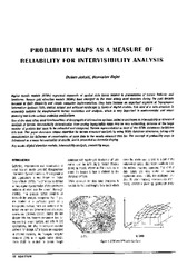
Probability maps as a measure of reliability for indivisibility analysis
(Institut za arhitekturu i urbanizam Srbije, Beograd, 2005)
Digital terrain models (DTMs) represent segments of spatial data bases related to presentation of terrain features and landforms. Square grid elevation models (DEMs) have emerged as the most widely used structure during ...