
Pretraživanje
Prikaz rezultata 11-20 od 38
The using GPS cinematic methods in geodetic works / Primena kinematičke metode GPS u geodetskim radovima
(Republički geodetski zavod Srbije, Beograd, 2003)
This article is explaining some standards of using GPS kinematics methods in engineering surveys. Results of GPS measurements were sufficiently accurate compared with data of terrestrial measurement.
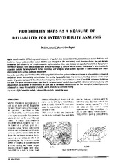
Probability maps as a measure of reliability for indivisibility analysis
(Institut za arhitekturu i urbanizam Srbije, Beograd, 2005)
Digital terrain models (DTMs) represent segments of spatial data bases related to presentation of terrain features and landforms. Square grid elevation models (DEMs) have emerged as the most widely used structure during ...
The application of the coefficients of the spheric harmonious development in the procedure of the determination functionally anomalic potential / Primena koeficijenata sferno-harmonijskog razvoja u postupku određivanja funkcionala anomalijskog potencijala
(Republički geodetski zavod Srbije, Beograd, 2002)
In the procedure of the determining functionally anomalic power, in the frame of the method remove-restore the first step presents the elimination of the long wave characteristics of the functionally with the application ...
The education of surveyors in Republic of Serbia / Sistem obrazovanja geodetskog kadra u Republici Srbiji
(Savez inženjera i tehničara Srbije, Beograd, 2009)
In Serbia, like in many other countries, there are three various levels of schools for surveyor's education: secondary, higher and academic (faculty). Except these, we must mention two academic, faculty levels - Master and ...
Recognition of common areas in a web page using a visualization approach
(Artificial Intelligence: Methodology, Systems and Applications, Proceedings, 2002)
Extracting and processing information from web pages is an important task in many areas like constructing search engines, information retrieval, and data mining from the Web. Common approach in the extraction process is ...

Fuzzy view of environment / Fuzzy pogled na životno okruženje
(Srpska akademija nauka i umetnosti SANU - Geografski institut 'Jovan Cvijić', Beograd, 2007)
A period of fifty years has been reached since the introduction of the first applications based upon geographical information systems (GIS). GIS has not only influenced the development of methods, collection techniques, ...
Elements of spatial data quality as information technology support for sustainable development planning
(Institut za arhitekturu i urbanizam Srbije, Beograd, 2004)
We are witnessing nowadays that the last decade of the past century, as well as the first years of the present one, have brought technology expansion with respect to spatial data gathering and processing which makes a ...
The land consolidation in the countries CEE/CIS / Komasacija zemljišta u zemljama centralne i istočne Evrope i zajednice nezavisnih država
(Republički geodetski zavod Srbije, Beograd, 2002)
Each country in transition must find out its own solution for land fragmentation, thus taking already acquired experience and main common principles of the countries in Central and Eastern Europe (CEE) and of the Commonwealth ...
Development of the geodetic services market and the private geodetic practice in the Republic of Serbia / Razvoj tržišta geodetskih poslova i privatne geodetske prakse u Republici Srbiji
(Republički geodetski zavod Srbije, Beograd, 2009)
The paper contains the analysis of the market conditions for the development of the private geodetic practice in the Republic of Serbia following the latest legislative amendments adopted in 2002. The analysis was done ...
New model of land consolidation and rural development in Serbia
(Institut za arhitekturu i urbanizam Srbije, Beograd, 2008)
Land consolidation is a set of spatial-planning, legal, organizational, economic and technical measures undertaken for the purpose of improving natural, economic and ecological living and labour conditions in a land ...