
Претраживање
Приказ резултата 31-40 од 148
Коришћење UAV фотограметрије и ласерског скенирања из ваздуха (LiDAR) приликом праћења активности клизишта на Умци
(Универзитет у Београду - Факултет безбедности, 2023)
Клизишта, као природне непогоде, егзистирају годинама, па у неком случајевима и више деценија. Због штетних последица које проузрокују, а како би се потенцијална опасност благовремено уочила и на време спречила, потребно ...
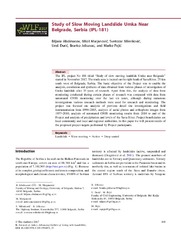
Study of Slow Moving Landslide Umka Near Belgrade, Serbia (IPL-181)
(Advancing Culture of Living With Landslides, Vol 1: Isdr-Icl Sendai Partnerships 2015-2025, 2017)
The IPL project No 181 titled "Study of slow moving landslide Umka near Belgrade" started in November 2012. The study area is located on the right bank of Sava River, 25 km south west of Belgrade, Serbia. The basic objective ...

Permanent GNSS monitoring of landslide Umka
(University of Banja Luka Faculty of Architecture, Civil Engineering and Geode, 2020)
The Umka landslide is one of the biggest inhabited active landslides in Serbia. The Umka landslide activity has been monitored for a period longer than 85 years, by various geotechnical and geodetic techniques. Since 2010, ...
Development of Rural Settlements in Land Consolidation
(Proceedengs of Papers, 1 st Serbian Geodetic Congress, International Scientific Conference, 1-3. December, 2011, 2011)

Within-field correlation between satellite-derived vegetation indices and grain yield of wheat
(BioSense Institute, Novi Sad, 2021)
This research aimed to inspect the correlation coefficients, during the crop growth stages, between vegetation indices (VIs) derived from Sentinel-2 imagery and grain winter wheat yield derived from yield monitoring and ...
Cadastre Reforms in Serbia Comparing to Document Cadastre 2014
(Proceedengs of Papers, 1 st Serbian Geodetic Congress, International Scientific Conference, 1-3. December, 2011, 2011)

Mobile laser scanning for detailed digital topographic mapping / Мобилно ласерско скенирање за детаљно дигитално топографско картирање
(University of Banja Luka Faculty of Architecture, Civil Engineering and Geodesy, 2022)
Mobile Laser Scanning (MLS) is a technique characterized by high data acquisition efficiency and
level of detail. However, a lot of information contained in the LiDAR point cloud is only implicitly
available. Therefore, ...
Implementation of Land Readjustment in Serbia – Based on Experiences in the City of Bor
(Faculty of Civil Engineering and Architecture, University of Nis, 2022)
The paper presents the process of implementing land readjustmentin the Republic of Serbia from the initial thinking, through the intensification of research and pilot projects to the first projects that are implemented in ...
3D Cadastral Data in The Process of Urban Planning
(Faculty of Civil Engineering and Architecture, University of Nis, 2022)
Cadastral data are very important in the process of urban planning. Moreover, cadastral data present a spatial base for urban planning decisions. Over the last few decades, research on 3D cadastres have been performed ...

AI in Agriculture
(1st Serbian International Conference on Applied Artificial Intelligence (SICAAI), Kragujevac, Serbia, 2022)
Soil organic carbon represents the main nutrient source for crop yields, which is of great importance to agricultural production. This research investigates the usage of a transfer learning-based neural network model to ...