
Pretraživanje
Prikaz rezultata 1-10 od 56
Challenges in P2P Data Management: Clustering
(7th International Conference on Software Engineering Advances, ICSEA 2022, Lisbon, Portugal, 16 - 20. October, 2022)
Intelligent Information Retrieval in Distributed Systems
(4th International Symposium on Smart and Healthy Cities, Shanghai, China, December 16-17, 2022, 2022)
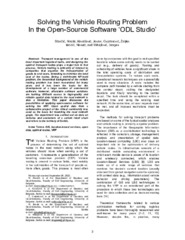
Solving the Vehicle Routing Problem In the Open-Source Software ‘ODL Studio’
(IPSI, Dalmatinska 55, 11000 Belgrade, Serbia, 2023)
Transport management is one of the most important logistical tasks, and the designing the optimal transport routes plays a major role in that process. Vehicle routing is primarily of interest to companies that organize the ...

New Downscaling Approach Using ESA CCI SM Products for Obtaining High Resolution Surface Soil Moisture
(MDPI, 2020)
ESA CCI SM products have provided remotely-sensed surface soil moisture (SSM) content with the best spatial and temporal coverage thus far, although its output spatial resolution of 25 km is too coarse for many regional ...

The Extension of IFC For Supporting 3D Cadastre LADM Geometry
(MDPI, 2021)
The growth of densely populated urban areas has caused traditional cadastral registration systems to face many difficulties in representing complex and multilevel property situations on 2D maps. These challenges, combined ...
APPLICATION OF PBL MODEL ON STUDY PROGRAM OF GEODESY AT THE FACULTY OF ARCHITECTURE, CIVIL ENGINEERING AND GEODESY AT THE UNIVERSITY OF BANJALUKA
(Arhitektonsko-Gradjevinsko-Geodetski fakultet Unverziteta u Banjojluci, 2020)
The subject of this paper is the application of the PBL model in the teaching process of the first cycle of studies at the Faculty of Architecture, Civil Engineering and Geodesy. The meaning of the term PBL model and its ...

Značaj geodetskog inženjerstva u inženjersko-tehničkim oblastima
(Savez inzenjera i tehnicara Srbije, 2020)
Rad se bavi zakonskim utemeljenjem uloge geodetske delatnosti u oblasti građevinskog inženjerstva u Republici Srbiji. Ukazuje se na permanentno umanjenje uloge geodetske struke u praksi što može dovesti do ozbiljnih posledica ...

Generalized habitat map of Serbia
(14th Symposium on the Flora of Southeastern Serbia and Neighboring Regions, 2022)
The generalized habitat map of Serbia is one of the products of the project carried out for the needs of the Institute for Nature Protection of Serbia by the Faculty of Biology University of Belgrade in cooperation with ...
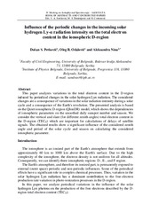
Influence of the periodic changes in the incoming solar hydrogen Ly-α radiation intensity on the total electron content in the ionospheric D-region
(2022)
This paper analyzes variations in the total electron content in the D-region induced by periodical changes in the solar hydrogen Lyα radiation. The considered changes are a consequence of variations in the solar radiation ...

Одређивање мерне несигурности резултата мерења просторног растојања применом глобалних навигационих сателитских система / Determination of spatial distance measurement uncertainty using global navigation satellite systems
(Друштво метролога, 2022)
Постоје четири у потпуности успостављена Глобална навигациона сателитска система (ГНСС): амерички GPS NAVSTAR, руски GLONASS, кинески BEIDOU (COMPASS) и европски GALILEO. Њиховом применом успешно се успостављају терестрички ...