
Претраживање
Приказ резултата 1-10 од 28
Different approach for calculation of inflow on storm water sewer pumping station: Case study KCS Nova 1 on New Belgrade / Mogućnosti za proračun protoka na kišnoj kanalizacionoj crpnoj stanici - primer KCS Nova 1, Novi Beograd
(Savez inženjera i tehničara Srbije, Beograd, 2012)
In the process of making mathematical models, a common problem is lack or missing data that could be used for calibration and verification of the model. In that case, we have to somehow use available data to calculate the ...

Sustainability of the concrete industry: Current trends and future outlook / Održivost industrije betona - savremeni trendovi i izgledi za budućnost
(Savez inženjera i tehničara Srbije, Beograd, 2017)
Achieving sustainability of all human actions has been recognized as an urgent and top priority since the warnings of anthropogenic climate change are overwhelming. However, the precise goal, aim and method of shifting the ...

Planning for sustainable development of local municipality / Planiranje održivog razvoja jedinice lokalne samouprave u Republici Srbiji
(Savez inženjera i tehničara Srbije, Beograd, 2012)
The problem of Sustainable Municipality development in Republic of Serbia is quite specific. All official agree that the development is quite slow or stopped. Forming the new association of communities and towns the process ...
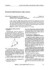
Mathematical models of rhumb line and their application / Matematički modeli loksodrome i njihova primena
(Savez inženjera i tehničara Srbije, Beograd, 2011)
The paper analyses some models of rhumb line on the ellipsoid, sphere and map projection. In geodesy and cartography, rhumb line is a complex curve on the earth's surface that crosses every meridian at the same oblique ...

Real estate valuation in the Republic of Serbia / Vrednovanje nepokretnosti u Republici Srbiji
(Savez inženjera i tehničara Srbije, Beograd, 2014)
There is no complete and systemized infrastructure for efficient and reliable evaluation of real estates in the Republic of Serbia. This is confirmed by analysis of the applicable regulations which treat valuation of real ...

Processing of ALS data using LAStools / Obrada podataka laserskog skeniranja korišćenjem LAStools softverskog paketa
(Savez inženjera i tehničara Srbije, Beograd, 2018)
The airborne laser scanning has been proven as very efficient method for collecting the surface data. As ALS collects extremely large amount of data, efficient use of this data involves the use of some semi-automatic or ...

Analysis of the terrestrial laser scanning georeferencing methods / Analiza metoda georeferenciranja podataka terestričkog laserskog skeniranja
(Savez inženjera i tehničara Srbije, Beograd, 2013)
From the point of engineering geodesy this paper discuses registration and georeferencing methods of the terrestrial laser scanning (TLS) data. The different functional and stochastic spatial transformation models of the ...
Creep and shrinkage of concrete according to Eurocode 2 / Deformacije tečenja i skupljanja betona prema Evrokodu 2
(Savez inženjera i tehničara Srbije, Beograd, 2017)
This paper presents the procedure for calculation of creep coefficient and shrinkage strain according to Eurocode 2 (SRPS EN 1992-1-1:2004). The calculated values of final creep coefficient and shrinkage strain, for the ...

Testing straightness of line objects using total least squares / Testiranje pravosti linijskih objekata primenom potpunog metoda najmanjih kvadrata
(Savez inženjera i tehničara Srbije, Beograd, 2017)
The paper presents the adaptation (fitting) of a set of points, with an estimated two-dimensional positions, to the straight line model of the by the application of the Weighted Total Least Squares, WTLS. The traditional ...

ISO 19157 standard application in technological process of the production of digital topographic maps / Primena ISO 19157 standarda u tehnološkom procesu izrade digitalnih topografskih karata
(Savez inženjera i tehničara Srbije, Beograd, 2014)
Standardization in the field of geographical information related to the definition of the system of collection, preparation, storage, maintenance, presentation and sharing of geographic information. Quality information of ...