
Претраживање
Приказ резултата 1-10 од 21

Application of a software package Topocad in geodetic works / Primena softverskog paketa Topocad u geodetskim radovima
(Savez inženjera i tehničara Srbije, Beograd, 2011)
Software package Topocad is used for processing and analysis of geodetic measurements. The program is developed by Swedish company Adtollo. It contains all the options that are most frequent in the surveying jobs. This ...
Impact of New Technologies for Spatial Data Acquisition and Management on Land Consolidations in Serbia
(INTERNATIONAL SCIENTIFIC CONFERENCE AND XXIV MEETING OF SERBIAN SURVEYORS ″″″″PROFESSIONAL PRACTICE AND EDUCATION IN GEODESY AND RELATED FIELDS″″″″ 24-26, June 2011, Kladovo - ,,Djerdap“ upon Danube, Serbia, 2011)
Significant innovations and improvements in the technologies for spatial data acquisition and management data
have emerged in the last few decades. Introduction of GPS and the technology of GIS and digital photogrammetry ...
Positional accuracy of geographical information and recent standards for its evaluation / Položajna tačnost geografskih informacija i savremeni standardi za njeno ocenjivanje
(Srpsko geografsko društvo, Beograd, 2011)
Positional accuracy is important quantity element of quality of geographical information in digital as well as in analoguos form. This paper points to importance and necessity of evaluation of positional accuracy in recent ...
Landslide susceptibility assessment using SVM machine learning algorithm
(Engineering Geology, 2011)
This paper introduces the current machine learning approach to solving spatial modeling problems in the domain of landslide susceptibility assessment. The latter is introduced as a classification problem, having multiple ...
Development of Rural Settlements in Land Consolidation
(Proceedengs of Papers, 1 st Serbian Geodetic Congress, International Scientific Conference, 1-3. December, 2011, 2011)
Cadastre Reforms in Serbia Comparing to Document Cadastre 2014
(Proceedengs of Papers, 1 st Serbian Geodetic Congress, International Scientific Conference, 1-3. December, 2011, 2011)
Optimization of Land Distribution in Urban Land Consolidation
(INTERNATIONAL SCIENTIFIC CONFERENCE AND XXIV MEETING OF SERBIAN SURVEYORS ″PROFESSIONAL PRACTICE AND EDUCATION IN GEODESY AND RELATED FIELDS″ 24-26, June 2011, Kladovo - ,,Djerdap“ upon Danube, Serbia, 2011)
This paper describes the legal framework and the problems of urban planning in the Republic of Serbia. Basic
principles of urban land consolidation whose application would improve the urban land development are discussed.
The ...
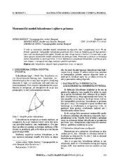
Mathematical models of rhumb line and their application / Matematički modeli loksodrome i njihova primena
(Savez inženjera i tehničara Srbije, Beograd, 2011)
The paper analyses some models of rhumb line on the ellipsoid, sphere and map projection. In geodesy and cartography, rhumb line is a complex curve on the earth's surface that crosses every meridian at the same oblique ...

Spatial modelling of population concentration using geographically weighted regression method
(Srpska akademija nauka i umetnosti SANU - Geografski institut 'Jovan Cvijić', Beograd, 2011)
This paper presents possibilities of applying the geographically weighted regression method in mapping population change index. During the last decade, this contemporary spatial modeling method has been increasingly used ...
On computational aspects of data processing of geodetic networks with large number of unknown parameters / O računskim aspektima obrade podataka geodetskih mreža s velikim brojem nepoznatih parametara
(Geodetski list, 2011)
Some special characteristics of linear systems of equations, which arise from geodetic network adjustment, optimization and pre-analysis, are outlined in this paper. Advantages and disadvantages of several methods for ...