
Претраживање
Приказ резултата 1-10 од 45
Experiences and procedures on making technical documentation for the objects of historical and cultural heritage
(International Society for Photogrammetry and Remote Sensing, 2004)
This paper evaluates advantages of application of digital photogrammetry for the purposes of production of technical documentation for the objects under protection, comparing it with the classical photogrammetric procedures. ...
Quality analysis of digital terrain models for the test area Zlatibor / Analiza kvaliteta digitalnog modela terena na lokaciji 'Zlatibor”
(Srpsko geografsko društvo, Beograd, 2003)
Digital terrain models (DTM) have recently become products which substitute standard methods for the terrain relief presentation. As a part of a Geographic Information Systems (GIS) they represent not only a data base ...
The application of the coefficients of the spheric harmonious development in the procedure of the determination functionally anomalic potential / Primena koeficijenata sferno-harmonijskog razvoja u postupku određivanja funkcionala anomalijskog potencijala
(Republički geodetski zavod Srbije, Beograd, 2002)
In the procedure of the determining functionally anomalic power, in the frame of the method remove-restore the first step presents the elimination of the long wave characteristics of the functionally with the application ...

Fuzzy view of environment / Fuzzy pogled na životno okruženje
(Srpska akademija nauka i umetnosti SANU - Geografski institut 'Jovan Cvijić', Beograd, 2007)
A period of fifty years has been reached since the introduction of the first applications based upon geographical information systems (GIS). GIS has not only influenced the development of methods, collection techniques, ...
Elements of spatial data quality as information technology support for sustainable development planning
(Institut za arhitekturu i urbanizam Srbije, Beograd, 2004)
We are witnessing nowadays that the last decade of the past century, as well as the first years of the present one, have brought technology expansion with respect to spatial data gathering and processing which makes a ...
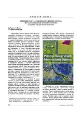
Peter Burrough i Rachael Mcdonnnell: Principi geografskih informacionih sistema - prostorni informacioni sistemi i geostatistika
(Republički geodetski zavod Srbije, Beograd, 2006)
Gerard B. M. Heuvelink, Prenos grešaka kod GIS modeliranja životne sredine, Građevinski fakultet, Beograd, 2007
(Republički geodetski zavod Srbije, Beograd, 2007)
The land consolidation in the countries CEE/CIS / Komasacija zemljišta u zemljama centralne i istočne Evrope i zajednice nezavisnih država
(Republički geodetski zavod Srbije, Beograd, 2002)
Each country in transition must find out its own solution for land fragmentation, thus taking already acquired experience and main common principles of the countries in Central and Eastern Europe (CEE) and of the Commonwealth ...
Development of the geodetic services market and the private geodetic practice in the Republic of Serbia / Razvoj tržišta geodetskih poslova i privatne geodetske prakse u Republici Srbiji
(Republički geodetski zavod Srbije, Beograd, 2009)
The paper contains the analysis of the market conditions for the development of the private geodetic practice in the Republic of Serbia following the latest legislative amendments adopted in 2002. The analysis was done ...
Status of orthophoto production and applications in Serbia
(International Society for Photogrammetry and Remote Sensing, 2004)
Paper reviews achieved level of orthophoto production in Serbia, with estimates on further developments in the next few years. Users, sources of financing, application areas, state and private sector partnership, etc. are ...