
Претраживање
Приказ резултата 21-30 од 45

Digitalni modeli terena - primarna geomorfometrijska baza podataka u GIS-u
(Srpsko geografsko društvo, Beograd, 2003)
Daljim razvojem tehnologije prikupljanja, obrade i vizuelizacije podataka o reljefu terena, DMT postaje sve više standardni produkt prikaza reljefa. Osobenosti ove baze podatka o visinama terena i njihova evidencija na ...
The influence to source of data for accuracy on Digital Terrain Models (DTM) / Uticaj izvora podataka na tačnost digitalnog modela terena
(Srpsko geografsko društvo, Beograd, 2005)
The overview of the contemporary data acquisition methods for Digital Terrain Models (DTM), as well as the accuracy of data provided by these methods, are given in this article. The procedure of the accuracy estimation for ...

The dividing of a line at a given scale applicated to the digitalization of the points coordinates / Podela duži u datoj srazmeri primenjena na digitalizaciju koordinata tačaka
(Republički geodetski zavod Srbije, Beograd, 2003)
An application of mathematical terms for dividing a given line at a given scale is suggested in the paper. Besides this, it is theoretically shown that a conditional adjustment is present in these simple formulae.

The TEMPUS project implementation on Faculty of civil engineering at the University of Belgrade, Department of geodesy and geoinformatics / Početak implementacije TEMPUS projekta na Građevinskom fakultetu u Beogradu - Odsek za geodeziju i geoinformatiku
(Republički geodetski zavod Srbije, Beograd, 2007)
The paper shows the contents of the TEMPUS project which was established in order to propose new master program in Land administration at the Department of geodesy and geoinformatics on the Faculty of civil engineering.

Evolving GIS technologies in nature conservation and the spatial planning strategy of Tara NP (Serbia) as a potential UNECSO MAB reserve / Primena GIS tehnologija u zaštiti prirodnih potencijala i strategiji prostornog planiranja NP Tara (Srbija) kao potencijalnog UNESCO MAB rezervata
(Srpsko geografsko društvo, Beograd, 2008)
Mt. Tara NP was nominated in 2004 within the UNESCO - ROSTE programme, for Man and the Biosphere (MAB) Reserve status in Serbia as transboundary 'Peace Park' status between Serbia and Bosnia & Herzegovina. Mt. Tara is one ...
New model of land consolidation and rural development in Serbia
(Institut za arhitekturu i urbanizam Srbije, Beograd, 2008)
Land consolidation is a set of spatial-planning, legal, organizational, economic and technical measures undertaken for the purpose of improving natural, economic and ecological living and labour conditions in a land ...
Production of country wide Dtm for serbia and montenegro
(International Society for Photogrammetry and Remote Sensing, 2004)
Project of building country wide DTM for Serbia and Montenegro is coming to its final phase. The project is based on scanning and vectorization of contours from existing 1:25000 topographic maps. Supplementing contour data ...
The using GPS cinematic methods in geodetic works / Primena kinematičke metode GPS u geodetskim radovima
(Republički geodetski zavod Srbije, Beograd, 2003)
This article is explaining some standards of using GPS kinematics methods in engineering surveys. Results of GPS measurements were sufficiently accurate compared with data of terrestrial measurement.
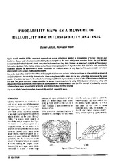
Probability maps as a measure of reliability for indivisibility analysis
(Institut za arhitekturu i urbanizam Srbije, Beograd, 2005)
Digital terrain models (DTMs) represent segments of spatial data bases related to presentation of terrain features and landforms. Square grid elevation models (DEMs) have emerged as the most widely used structure during ...