
Претраживање
Приказ резултата 11-20 од 58
Application of geostatistics in spatial analyses / Primena geostatistike u prostornim analizama
(Srpsko geografsko društvo, Beograd, 2007)
During the last decade, the development of computational technique has influenced wider implementation of numerical methods in different software applications, which are oriented to processing, presentation, and analysis ...
Historical review of astro-geodetic observations in Serbia
(Proceedings of the Meeting Studying Nature Through Centuries - 120th Anniversary of Belgrade Observa, 2008)
Astro-geodetic determinations of vertical deflections in Serbia began during the first years of 20th century. The first field works were led by S. Boskovic. After the 2nd World War, Military Geographic Institute, Department ...
Procedures and Experiences on Using Desktop Scanner for Orthophoto Production
(International Society for Photogrammetry and Remote SensingCenkler Matbaasi,Istambul, 2004)
Paper presents procedures and experiences on using low cost desktop scanner Epson Expression 1640XL for orthophoto production.Complete process of scanning, scanner calibration and removal of systematic distortions of scanned ...
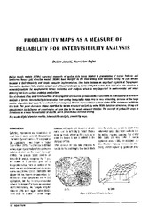
Probability maps as a measure of reliability for indivisibility analysis
(Institut za arhitekturu i urbanizam Srbije, Beograd, 2005)
Digital terrain models (DTMs) represent segments of spatial data bases related to presentation of terrain features and landforms. Square grid elevation models (DEMs) have emerged as the most widely used structure during ...
Crawling the construction web - A machine-learning approach without negative examples
(Applied Artificial Intelligence, 2008)
Professionals and craftsmen in the construction sector make an intensive use of information in their decision-making processes but only make limited use of the abundant information, that is potentially available to them, ...
The application of the coefficients of the spheric harmonious development in the procedure of the determination functionally anomalic potential / Primena koeficijenata sferno-harmonijskog razvoja u postupku određivanja funkcionala anomalijskog potencijala
(Republički geodetski zavod Srbije, Beograd, 2002)
In the procedure of the determining functionally anomalic power, in the frame of the method remove-restore the first step presents the elimination of the long wave characteristics of the functionally with the application ...
Landslide susceptibility assessment with machine learning algorithms
(2009 International Conference On Intelligent Networking and Collaborative Systems (Incos 2009), 2009)
Case study addresses NW slopes of Fruska Gora Mountain, Serbia. Landslide activity is quite notorious in this region, especially along the Danube's right river bank, and recently intensified seismicity coupled with atmospheric ...
Real Estate Cadastre Development in Serbia
(Geodetski list, 2009)
This paper provides an overview development and the real estate cadastre maintenance in the Republic of Serbia. The State has recognized that an effective national property rights system is prerequisite for economic growth ...
Experience from professional visit to Germany: 'Follow-up' workshop / Iskustva sa stručne posete Nemačkoj - 'follow-up' radionica
(Republički geodetski zavod Srbije, Beograd, 2009)
The paper presents the experience acquired in the study tour, the German education sector, with special attention to the organization of student associations, operating processes cadastral services and private practice students.
Implementation of the CORINE Land Cover project in Serbia and Montenegro / Implementacija CORINE Land Cover projekta u Srbiji i Crnoj Gori
(Republički geodetski zavod Srbije, Beograd, 2006)
In order to bring Serbia and Montenegro to the same line of activities as the rest of the European countries in relation to assessing the land cover resources, European Commission decided to support implementation of the ...