
Search
Now showing items 21-30 of 45
Elements of spatial data quality as information technology support for sustainable development planning
(Institut za arhitekturu i urbanizam Srbije, Beograd, 2004)
We are witnessing nowadays that the last decade of the past century, as well as the first years of the present one, have brought technology expansion with respect to spatial data gathering and processing which makes a ...
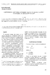
The acquisition of radius of the circle objects inaccessible for the direct measurement / Određivanje prečnika kružnih objekata (cevi) nepristupačnih za direktno merenje
(Republički geodetski zavod Srbije, Beograd, 2003)
This paper deals with the problem of obtaining radius of the circle objects which are heavy to be occupied. It is assumed that we have total station for getting the job.
The using GPS cinematic methods in geodetic works / Primena kinematičke metode GPS u geodetskim radovima
(Republički geodetski zavod Srbije, Beograd, 2003)
This article is explaining some standards of using GPS kinematics methods in engineering surveys. Results of GPS measurements were sufficiently accurate compared with data of terrestrial measurement.
Experiences and procedures on making technical documentation for the objects of historical and cultural heritage
(International Society for Photogrammetry and Remote Sensing, 2004)
This paper evaluates advantages of application of digital photogrammetry for the purposes of production of technical documentation for the objects under protection, comparing it with the classical photogrammetric procedures. ...
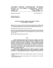
Quality analysis of digital terrain models for the test area Zlatibor / Analiza kvaliteta digitalnog modela terena na lokaciji 'Zlatibor”
(Srpsko geografsko društvo, Beograd, 2003)
Digital terrain models (DTM) have recently become products which substitute standard methods for the terrain relief presentation. As a part of a Geographic Information Systems (GIS) they represent not only a data base ...

Evolving GIS technologies in nature conservation and the spatial planning strategy of Tara NP (Serbia) as a potential UNECSO MAB reserve / Primena GIS tehnologija u zaštiti prirodnih potencijala i strategiji prostornog planiranja NP Tara (Srbija) kao potencijalnog UNESCO MAB rezervata
(Srpsko geografsko društvo, Beograd, 2008)
Mt. Tara NP was nominated in 2004 within the UNESCO - ROSTE programme, for Man and the Biosphere (MAB) Reserve status in Serbia as transboundary 'Peace Park' status between Serbia and Bosnia & Herzegovina. Mt. Tara is one ...
New model of land consolidation and rural development in Serbia
(Institut za arhitekturu i urbanizam Srbije, Beograd, 2008)
Land consolidation is a set of spatial-planning, legal, organizational, economic and technical measures undertaken for the purpose of improving natural, economic and ecological living and labour conditions in a land ...

GIS in development of urban plan: Example of Vrnjačka Banja / GIS u izradi urbanističkog plana - primer Vrnjačke Banje
(Institut za arhitekturu i urbanizam Srbije, Beograd, 2009)
This paper illustrate experiences of GIS based spatial geodatabase design realization and development for implementation and monitoring of urban plans. As key study authors used Urban Plan of Vrnjačka Banja created in year ...

Activities on improving the process of land consolidation in Serbia / Aktivnosti na unapređenju procesa komasacije u Srbiji
(Republički geodetski zavod Srbije, Beograd, 2006)
Small size of agricultural parcels, great dispersion and uneconomically shaped parcels are some of the main structural problems of Serbian agriculture. Bearing the fact that Serbia is one of the most rural jurisdictions ...
The influence to source of data for accuracy on Digital Terrain Models (DTM) / Uticaj izvora podataka na tačnost digitalnog modela terena
(Srpsko geografsko društvo, Beograd, 2005)
The overview of the contemporary data acquisition methods for Digital Terrain Models (DTM), as well as the accuracy of data provided by these methods, are given in this article. The procedure of the accuracy estimation for ...