
Претраживање
Приказ резултата 1-10 од 28
Display of general solutions for disposal of waste and storm waters in the villages Blace and Brus / Prikaz generalnih rešenja odvođenja upotrebljenih i kišnih voda naselja Brus i Blace
(Udruženje za tehnologiju vode i sanitarno inžinjerstvo, Beograd, 2013)
This paper presents a general solutions for disposal of waste and atmospheric waters in the villages Blace and Brus, which were prepared under the IPA III component PPF4 - Project Preparation Facility 4, IPA 2010. Legislation ...

ISO 19157 standard application in technological process of the production of digital topographic maps / Primena ISO 19157 standarda u tehnološkom procesu izrade digitalnih topografskih karata
(Savez inženjera i tehničara Srbije, Beograd, 2014)
Standardization in the field of geographical information related to the definition of the system of collection, preparation, storage, maintenance, presentation and sharing of geographic information. Quality information of ...

Second order design of geodetic network using different TK structured criterion matrices / Optimizacija drugog reda geodetske mreže korišćenjem različitih kriterijum matrica TK strukture
(Savez inženjera i tehničara Srbije, Beograd, 2012)
Geodetic network design for numerous practical applications (surveying, staking out of characteristic points of an object in construction, control of geometry of a built-up object, monitoring, etc) represents a problem ...

Determination of deflection of the vertical components by using global geopotential model EGM2008 / Određivanje komponenti odstupanja vertikale primenom globalnog geopotencijalnog modela EGM2008
(Savez inženjera i tehničara Srbije, Beograd, 2018)
This paper presents the determination of the vertical deflection components using the Global Geopotential Model EGM2008. The components are defined in two groups of points: 4083 points are relatively correctly distributed ...
Evaluation of normal heights by the means of global navigation satellite systems and global geopotential model
(Glasnik Srpskog geografskog drustva, 2015)
This paper presents geometrically and physically defined height systems, along with their evaluation by the means of Global Navigation Satellite Systems (GNSS) and Global Geopotential Models (GGM). The paper defines ellipsoid ...

Testing straightness of line objects using total least squares / Testiranje pravosti linijskih objekata primenom potpunog metoda najmanjih kvadrata
(Savez inženjera i tehničara Srbije, Beograd, 2017)
The paper presents the adaptation (fitting) of a set of points, with an estimated two-dimensional positions, to the straight line model of the by the application of the Weighted Total Least Squares, WTLS. The traditional ...

Processing of ALS data using LAStools / Obrada podataka laserskog skeniranja korišćenjem LAStools softverskog paketa
(Savez inženjera i tehničara Srbije, Beograd, 2018)
The airborne laser scanning has been proven as very efficient method for collecting the surface data. As ALS collects extremely large amount of data, efficient use of this data involves the use of some semi-automatic or ...

Real estate valuation in the Republic of Serbia / Vrednovanje nepokretnosti u Republici Srbiji
(Savez inženjera i tehničara Srbije, Beograd, 2014)
There is no complete and systemized infrastructure for efficient and reliable evaluation of real estates in the Republic of Serbia. This is confirmed by analysis of the applicable regulations which treat valuation of real ...

Concept of spatial coordinate systems, their defining and implementation as a precondition in geospatial applications / Koncept prostornih koordinatnih sistema, njihovo definisanje i realizacija kao preduslov u geoprostornim primenama
(Srpsko geografsko društvo, Beograd, 2015)
There are many users of spatial information, and quite large interest about the nature and genesis of such information. Different users found spatial information in the form of maps, plans or alphanumerical tables. Recently, ...
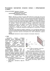
Еталонирање терестричких ласерских скенера у лабораторијским условима
(Техника, 2019)
Терестричко ласерско скенирање (ТЛС) представља методу брзог прикупљања велике количине података у виду „облака тачака“ који нам касније представља основу за приказивање реалног стања „објекта“ у виду тродимензионалног ...