
Претраживање
Приказ резултата 11-20 од 31

GIS in development of urban plan: Example of Vrnjačka Banja / GIS u izradi urbanističkog plana - primer Vrnjačke Banje
(Institut za arhitekturu i urbanizam Srbije, Beograd, 2009)
This paper illustrate experiences of GIS based spatial geodatabase design realization and development for implementation and monitoring of urban plans. As key study authors used Urban Plan of Vrnjačka Banja created in year ...

Integration of CAD and GIS technology using ArcGIS for development of building information systems / Integracija CAD i GIS tehnologije za potrebe izrade informacionih sistema objekata korišćenjem ARCGIS-a
(Savez inženjera i tehničara Srbije, Beograd, 2014)
Paper will present basic definitions and significance of implementation of information systems for facility maintenance, as well as terms Facility management (FM) and FM lifecycle. The main focus of this paper is on CAD ...
Mapping probabilities of precipitation occurrence on the territory of the Republic of Serbia by the method of indicator kriging / Kartiranje verovatnoća pojave kišnih padavina na teritoriji Republike Srbije metodom indikatorskog kriginga
(Srpsko geografsko društvo, Beograd, 2013)
This paper presents the application of indicator kriging as a geostatistical method for the purpose of creating maps of precipitation occurrence probabilities on the territory of the Republic of Serbia for distinctive ...
Evaluation of normal heights by the means of global navigation satellite systems and global geopotential model
(Glasnik Srpskog geografskog drustva, 2015)
This paper presents geometrically and physically defined height systems, along with their evaluation by the means of Global Navigation Satellite Systems (GNSS) and Global Geopotential Models (GGM). The paper defines ellipsoid ...

Real estate appraisal and its role in sustainable Republic of Serbia real estate market development / Procena vrednosti nepokretnosti i njena uloga u održivom razvoju tržišta nepokretnosti u Republici Srbiji
(Savez inženjera i tehničara Srbije, Beograd, 2012)
Most of the developed countries have accepted the concept of calculating property tax based on the value of real estate. To be able to determine the value of real estate over the same time, undertook the creation of models ...
Concept of implementation of consolidation in Serbia / Koncept sprovođenja komasacije u Republici Srbiji
(Savez inženjera i tehničara Srbije, Beograd, 2016)
Land consolidation means a system of spatial planning, technical, legal and socio-economic measures takes by the community for a fundamental improvement of natural, economic and environmental conditions of the land territory ...

Spatial modelling of population concentration using geographically weighted regression method
(Srpska akademija nauka i umetnosti SANU - Geografski institut 'Jovan Cvijić', Beograd, 2011)
This paper presents possibilities of applying the geographically weighted regression method in mapping population change index. During the last decade, this contemporary spatial modeling method has been increasingly used ...

Algorithm for water distribution network segmentation using existing isolation valves / Algoritam za segmentaciju vodovodne mreže pomoću postojećih izolacionih zatvarača
(Udruženje za tehnologiju vode i sanitarno inžinjerstvo, Beograd, 2014)
Dividing a complex water distribution network (segmentation) on smaller zones, with defined entry and exit points, is a precondition for better water loss management. In order to obtain these zones, often called District ...
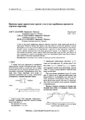
The application of the right rectangular prism in the process determining the value of terrain correction / Primena prave pravougaone prizme u postupku određivanja vrednosti terenske korekcije
(Savez inženjera i tehničara Srbije, Beograd, 2015)
The effects of topographic masses on gravity were determined for the territory of Serbia by using the digital terrain model with resolution of 1 arch second in both directions. For the effect of distant masses, i.e. masses ...

Application of a software package Topocad in geodetic works / Primena softverskog paketa Topocad u geodetskim radovima
(Savez inženjera i tehničara Srbije, Beograd, 2011)
Software package Topocad is used for processing and analysis of geodetic measurements. The program is developed by Swedish company Adtollo. It contains all the options that are most frequent in the surveying jobs. This ...