
Претраживање
Приказ резултата 21-30 од 31

Concept of spatial coordinate systems, their defining and implementation as a precondition in geospatial applications / Koncept prostornih koordinatnih sistema, njihovo definisanje i realizacija kao preduslov u geoprostornim primenama
(Srpsko geografsko društvo, Beograd, 2015)
There are many users of spatial information, and quite large interest about the nature and genesis of such information. Different users found spatial information in the form of maps, plans or alphanumerical tables. Recently, ...

Processing of ALS data using LAStools / Obrada podataka laserskog skeniranja korišćenjem LAStools softverskog paketa
(Savez inženjera i tehničara Srbije, Beograd, 2018)
The airborne laser scanning has been proven as very efficient method for collecting the surface data. As ALS collects extremely large amount of data, efficient use of this data involves the use of some semi-automatic or ...
Optimization of pressurized pipe networks modelled with ΔQ method / Optimizacija mreža pod pritiskom modeliranih ΔQ metodom
(Jugoslovensko društvo za odvodnjavanje i navodnjavanje, Beograd, 2013)
Efficiency of optimization of water networks in terms of expenditure of computer running time depends on the speed of the hydraulic calculations. In this paper use of the ΔQ method for network calculation, was tested on ...

Analysis of the terrestrial laser scanning georeferencing methods / Analiza metoda georeferenciranja podataka terestričkog laserskog skeniranja
(Savez inženjera i tehničara Srbije, Beograd, 2013)
From the point of engineering geodesy this paper discuses registration and georeferencing methods of the terrestrial laser scanning (TLS) data. The different functional and stochastic spatial transformation models of the ...

ISO 19157 standard application in technological process of the production of digital topographic maps / Primena ISO 19157 standarda u tehnološkom procesu izrade digitalnih topografskih karata
(Savez inženjera i tehničara Srbije, Beograd, 2014)
Standardization in the field of geographical information related to the definition of the system of collection, preparation, storage, maintenance, presentation and sharing of geographic information. Quality information of ...

Doprinos određivanju jonosferskog kašnjenja GNSS satelitskih signala na teritoriji Republike Srbije
(Savez inženjera i tehničara Srbije, Beograd, 2023)
Višefrekvencijski GNSS satelitski signali i njihova dostupnost omogućavaju istraživanja u nediferenciranom i nekombinovanom modelu u kome je pojedinačni signal na svakoj frekvenciji odgovarajuće nezavisno opažanje. Ovakve ...

Determination of deflection of the vertical components by using global geopotential model EGM2008 / Određivanje komponenti odstupanja vertikale primenom globalnog geopotencijalnog modela EGM2008
(Savez inženjera i tehničara Srbije, Beograd, 2018)
This paper presents the determination of the vertical deflection components using the Global Geopotential Model EGM2008. The components are defined in two groups of points: 4083 points are relatively correctly distributed ...
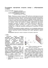
Еталонирање терестричких ласерских скенера у лабораторијским условима
(Техника, 2019)
Терестричко ласерско скенирање (ТЛС) представља методу брзог прикупљања велике количине података у виду „облака тачака“ који нам касније представља основу за приказивање реалног стања „објекта“ у виду тродимензионалног ...

Algorithm for water distribution network segmentation using existing isolation valves / Algoritam za segmentaciju vodovodne mreže pomoću postojećih izolacionih zatvarača
(Udruženje za tehnologiju vode i sanitarno inžinjerstvo, Beograd, 2014)
Dividing a complex water distribution network (segmentation) on smaller zones, with defined entry and exit points, is a precondition for better water loss management. In order to obtain these zones, often called District ...

Designing optimal transport routes using open-source software / Izrada optimalnih transportnih ruta korišćenjem softvera otvorenog koda
(Savez inženjera i tehničara Srbije, Beograd, 2018)
Vehicle routing plays a major role in the industry, primarily in companies that organize the transport of goods to end-users. The theoretical background of the vehicle routing problem has been known for many years and it ...