
Претраживање
Приказ резултата 21-30 од 31

Determination of deflection of the vertical components by using global geopotential model EGM2008 / Određivanje komponenti odstupanja vertikale primenom globalnog geopotencijalnog modela EGM2008
(Savez inženjera i tehničara Srbije, Beograd, 2018)
This paper presents the determination of the vertical deflection components using the Global Geopotential Model EGM2008. The components are defined in two groups of points: 4083 points are relatively correctly distributed ...

Designing optimal transport routes using open-source software / Izrada optimalnih transportnih ruta korišćenjem softvera otvorenog koda
(Savez inženjera i tehničara Srbije, Beograd, 2018)
Vehicle routing plays a major role in the industry, primarily in companies that organize the transport of goods to end-users. The theoretical background of the vehicle routing problem has been known for many years and it ...
Sizing and calibration of urban stormwater infiltration system in Belgrade / Dimenzionisanje i kalibracija sistema za infiltraciju kišnice na urbanom slivu u Beogradu
(Jugoslovensko društvo za odvodnjavanje i navodnjavanje, Beograd, 2016)
This work shows a way to size and calibrate parameters of urban stormwater collection and treatment infiltration system. Its design allows collection of stormwater runoff events for a 2 year return period and infiltration ...
Evaluation of normal heights by the means of global navigation satellite systems and global geopotential model
(Glasnik Srpskog geografskog drustva, 2015)
This paper presents geometrically and physically defined height systems, along with their evaluation by the means of Global Navigation Satellite Systems (GNSS) and Global Geopotential Models (GGM). The paper defines ellipsoid ...
Mapping probabilities of precipitation occurrence on the territory of the Republic of Serbia by the method of indicator kriging / Kartiranje verovatnoća pojave kišnih padavina na teritoriji Republike Srbije metodom indikatorskog kriginga
(Srpsko geografsko društvo, Beograd, 2013)
This paper presents the application of indicator kriging as a geostatistical method for the purpose of creating maps of precipitation occurrence probabilities on the territory of the Republic of Serbia for distinctive ...
Пројекат геодетског осматрања дела потпорног зида на аутопуту Е75 у хоризонталној равни
(Tehnika, 2019)
Деоница аутопута Е75, од Грабовнице до Левосоје, која представља јужни крак Коридора X,
подељена је на 5 деоница. За потребе реализације главног пројекта, извршен је вертикални засек терена. Паралелно са радом на засеку, ...

Estimation of flow accumulation uncertainty by Monte Carlo stochastic simulations / Ocena nesigurnosti prostorne koncentracije oticaja primenom Monte Karlo stohastičkih simulacija
(Univerzitet u Beogradu - Šumarski fakultet, Beograd, 2013)
Very often, outputs provided by GIS functions and analysis are assumed as exact results. However, they are influenced by certain uncertainty which may affect the decisions based on those results. It is very complex and ...

Planning for sustainable development of local municipality / Planiranje održivog razvoja jedinice lokalne samouprave u Republici Srbiji
(Savez inženjera i tehničara Srbije, Beograd, 2012)
The problem of Sustainable Municipality development in Republic of Serbia is quite specific. All official agree that the development is quite slow or stopped. Forming the new association of communities and towns the process ...
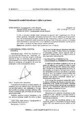
Mathematical models of rhumb line and their application / Matematički modeli loksodrome i njihova primena
(Savez inženjera i tehničara Srbije, Beograd, 2011)
The paper analyses some models of rhumb line on the ellipsoid, sphere and map projection. In geodesy and cartography, rhumb line is a complex curve on the earth's surface that crosses every meridian at the same oblique ...
Optmizacija broja i rasporeda orijentacionih tačaka konfigurisanih za snimanje UAV metodom
(Tehnika, 2022)
Cilj ovog istraživanja je da prikaže najoptimalnije rešenje u pogledu položaja i broja orijentacionih tačaka (GCP) za potrebe snimanja terena primenom UAV metode na području prigradskog naselja Duboko kod Umke. Obrada ...