
Pretraživanje
Prikaz rezultata 21-30 od 136

Analysis of the terrestrial laser scanning georeferencing methods / Analiza metoda georeferenciranja podataka terestričkog laserskog skeniranja
(Savez inženjera i tehničara Srbije, Beograd, 2013)
From the point of engineering geodesy this paper discuses registration and georeferencing methods of the terrestrial laser scanning (TLS) data. The different functional and stochastic spatial transformation models of the ...
Geometric deformation analysis in free geodetic networks: case study for Fruska Gora in Serbia
(Academy of Sciences of the Czech Republic,, 2017)
The deformation measurements are performed for the purpose of obtaining information concerning ground movement and objects on the ground within given time intervals. For the purpose of improving conventional models of ...
Geodata management by developing of national data infrastructure in the republic of Serbia
(Geodetski vestnik, 2014)
Sharing of spatial information between the state establishments and private sector, based on standards for technical infrastructure of spatial data and services, is the strategic objective of the Mid-Term Program of Works ...

Testing straightness of line objects using total least squares / Testiranje pravosti linijskih objekata primenom potpunog metoda najmanjih kvadrata
(Savez inženjera i tehničara Srbije, Beograd, 2017)
The paper presents the adaptation (fitting) of a set of points, with an estimated two-dimensional positions, to the straight line model of the by the application of the Weighted Total Least Squares, WTLS. The traditional ...
Quality analysis of digital terrain models for the test area Zlatibor / Analiza kvaliteta digitalnog modela terena na lokaciji 'Zlatibor”
(Srpsko geografsko društvo, Beograd, 2003)
Digital terrain models (DTM) have recently become products which substitute standard methods for the terrain relief presentation. As a part of a Geographic Information Systems (GIS) they represent not only a data base ...
High resolution grid of potential incoming solar radiation for Serbia
(Univerzitet u Beogradu - Institut za nuklearne nauke Vinča, Beograd, 2015)
Solar radiation is a key driving force for many natural processes. At the Earth's surface solar radiation is the result of complex interactions between the atmosphere and Earth's surface. Our study highlights the development ...
The using GPS cinematic methods in geodetic works / Primena kinematičke metode GPS u geodetskim radovima
(Republički geodetski zavod Srbije, Beograd, 2003)
This article is explaining some standards of using GPS kinematics methods in engineering surveys. Results of GPS measurements were sufficiently accurate compared with data of terrestrial measurement.
Digital terrain models as topographic layouts for civil engineering design / Digitalni modeli terena kao podloge za projektovanje u građevinarstvu
(Savez građevinskih inženjera Srbije, Beograd, 2010)
The concept and the production of Digital Terrain Models (DTM) has drawn a lot of attention of spatial data users. In addition to numerous improvements that were made in data collection technologies, big market with wide ...
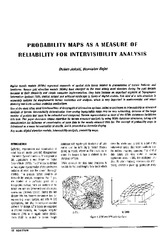
Probability maps as a measure of reliability for indivisibility analysis
(Institut za arhitekturu i urbanizam Srbije, Beograd, 2005)
Digital terrain models (DTMs) represent segments of spatial data bases related to presentation of terrain features and landforms. Square grid elevation models (DEMs) have emerged as the most widely used structure during ...
Control of geometry of engineering facilities by geodetic methods / Kontrola geometrije inženjerskih objekata geodetskim metodama
(Savez građevinskih inženjera Srbije, Beograd, 2013)
In this paper we present a method for control of geometry of engineering facility by geodetic methods. Control of geometry can be performed by location, shape and size and shape only. Paper also presents all necessary ...