
Претраживање
Приказ резултата 21-30 од 207
Soil type classification and estimation of soil properties using support vector machines
(Geoderma, 2010)
Quantitative techniques for prediction and classification in soil survey are developing rapidly. The paper introduces application of Support Vector Machines in the estimate of values of soil properties and soil type ...
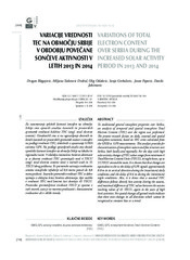
Variations of total electron content over Serbia during the increased solar activity period in 2013 and 2014
(Zvava Geodetov Slovenije, 2016)
To understand general ionosphere properties over Serbia, an analysis of temporal and spatial ionosphere Total Electron Content (TEC) over the region was performed. The present research focuses on daily, seasonal and spatial ...
Establishment of the MGI EDM calibration baseline
(Survey Review, 2013)
This paper deals with the estimation of the quality of the baseline for the calibration of distance measurement devices which was established by Serbian Military Geographic Institute for military use. The basic characteristics ...
Terrain correction computations using digital density model of topographic masses
(Zvava Geodetov Slovenije, 2018)
This paper presents the determination of terrain correction by the means of the Digital Density Model (DDM) of topographic masses (Earth's crust mass above the geoid) for the territory of Serbia. The DDM is determined using ...
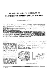
Probability maps as a measure of reliability for indivisibility analysis
(Institut za arhitekturu i urbanizam Srbije, Beograd, 2005)
Digital terrain models (DTMs) represent segments of spatial data bases related to presentation of terrain features and landforms. Square grid elevation models (DEMs) have emerged as the most widely used structure during ...
Metoda laserskog skeniranja u geodetskom inženjerstvu
(Građevinski kalendar, 2017)

Second order design of geodetic network using different TK structured criterion matrices / Optimizacija drugog reda geodetske mreže korišćenjem različitih kriterijum matrica TK strukture
(Savez inženjera i tehničara Srbije, Beograd, 2012)
Geodetic network design for numerous practical applications (surveying, staking out of characteristic points of an object in construction, control of geometry of a built-up object, monitoring, etc) represents a problem ...
Crawling the construction web - A machine-learning approach without negative examples
(Applied Artificial Intelligence, 2008)
Professionals and craftsmen in the construction sector make an intensive use of information in their decision-making processes but only make limited use of the abundant information, that is potentially available to them, ...
Maintenance of the state survey in the Republic of Montenegro
(Survey Review, 2018)
The paper provides an overview of the maintenance of the state survey, as the foundation for the development of the geodetic infrastructure, real estate cadastre, mapping and the National Spatial Data Infrastructure (NSDI) ...
Geometric Proportional Schemas of Serbian Medieval Raška Churches Based on Stambuk's Proportional Canon
(Birkhauser Verlag AG, 2019)
In this paper, an analysis of three Serbian medieval Raška churches highlights the significance of the interaction of regular geometric shapes in the composition of their underlying proportional scheme. The complex geometry ...